Lavington night lights from space
Night Light of Lavington (New South Wales) from space (Australia) Src. Average luminocity for 10x10km area is 41.3462% and for 50x50km: 4.1701%.
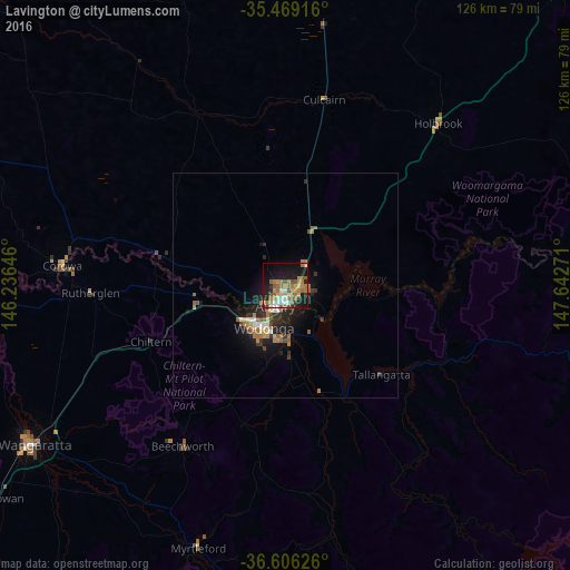
Analysis of Lavington night lights 2016
Square area 10x10 km:
 4.4%
4.4%90-99
4.4%80-89
4.58%70-79
9.16%60-69
12.27%50-59
10.99%40-49
1.83%30-39
2.2%20-29
7.88%10-19
29.67%0-9
12.64%Square area 50x50 km:
0.38%90-99
0.44%80-89
0.29%70-79
0.73%60-69
1.02%50-59
0.84%40-49
0.29%30-39
0.44%20-29
1.42%10-19
3.56%0-9
90.6%Clear (daylight) street map image can be seen on geolist.org.
Map coordinates:
35° 28' 9" South, 146° 14' 11.3" East
36° 2' 23.1" South, 146° 56' 22.5" East
36° 36' 22.5" South, 147° 38' 33.8" East
Some cities around Lavington sort by population:
• Wodonga
10.2 km =6.3 mi,  206°
206°
• Wangaratta
65.9 km =40.9 mi,  237°
237°
• West Wodonga
12.2 km =7.6 mi,  220°
220°
• Thurgoona
5.1 km =3.2 mi,  85°
85°
• East Albury
4.7 km =2.9 mi,  190°
190°
• North Albury
2.1 km =1.3 mi,  203°
203°
• Albury
4.1 km =2.5 mi, 199°
• Corowa
50.1 km =31.1 mi,  275°
275°
2160493 (p: 12,334)
Sources (retrieved 2019-11-25):
» Earth at Night: Flat Maps 2012, 2016