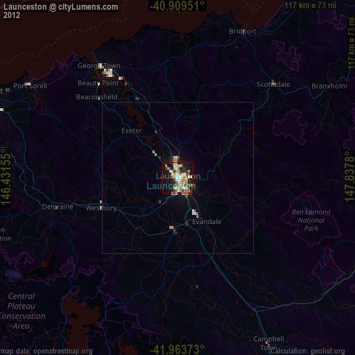
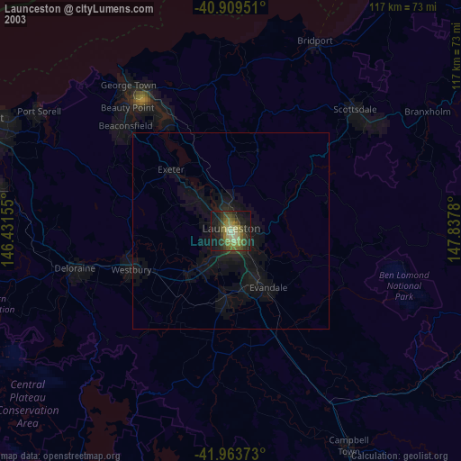
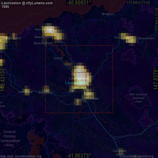
Launceston night lights from space
Night Light of Launceston (Tasmania) from space (Australia) Src. Average luminocity for 10x10km area is 45.3299% and for 50x50km: 2.7151%.
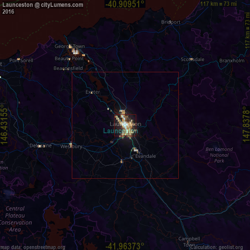
Analysis of Launceston night lights 2016
Square area 10x10 km:
 4.25%
4.25%90-99
5.27%80-89
10.54%70-79
8.5%60-69
6.63%50-59
12.07%40-49
3.91%30-39
2.72%20-29
11.73%10-19
29.59%0-9
4.76%Square area 50x50 km:
0.19%90-99
0.27%80-89
0.49%70-79
0.45%60-69
0.29%50-59
0.62%40-49
0.29%30-39
0.28%20-29
0.61%10-19
2.34%0-9
94.18%Clear (daylight) street map image can be seen on geolist.org.
Map coordinates:
40° 54' 34.2" South, 146° 25' 53.6" East
41° 26' 19.5" South, 147° 8' 4.8" East
41° 57' 49.4" South, 147° 50' 16.1" East
Some cities around Launceston sort by population:
• Burnie
111.4 km =69.2 mi,  292°
292°
• Devonport
71.6 km =44.5 mi, 293°
• Claremont
149.8 km =93.1 mi,  176°
176°
• Newnham
5.7 km =3.5 mi,  342°
342°
• Riverside
7.3 km =4.5 mi, 285°
• Ulverstone
85.4 km =53.1 mi, 291°
• Wynyard
128 km =79.5 mi, 292°
• New Norfolk
149.6 km =93 mi, 182°
2160517 (p: 106,153)
Sources (retrieved 2019-11-25):
» NASA, Earths city lights 1995
» NASA city lights 2003
» Earth at Night: Flat Maps 2012, 2016