Kenwick night lights from space
Night Light of Kenwick (Western Australia) from space (Australia) Src. Average luminocity for 10x10km area is 82.458% and for 50x50km: 41.6816%.
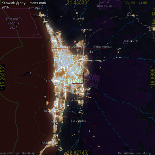
Analysis of Kenwick night lights 2016
Square area 10x10 km:
 19.93%
90-99
22.73%80-89
13.29%70-79
21.5%60-69
11.89%50-59
7.17%40-49
2.97%30-39
0.52%20-29
0%10-19
0%0-9
0%Square area 50x50 km:
9.3%90-99
9.98%80-89
4.73%70-79
6.2%60-69
8.18%50-59
4.78%40-49
3.49%30-39
3.52%20-29
7.02%10-19
8.45%0-9
34.35%Clear (daylight) street map image can be seen on geolist.org.
Map coordinates:
31° 26' 7.2" South, 115° 15' 48.8" East
32° 1' 60" South, 115° 58' 0" East
32° 37' 38.8" South, 116° 40' 11.3" East
Some cities around Kenwick sort by population:
• Thornlie
3.2 km =2 mi,  200°
200°
• Maddington
2.4 km =1.5 mi,  139°
139°
• Beckenham
1.1 km =0.7 mi,  325°
325°
• Queens Park
3.9 km =2.4 mi, 330°
• Wattle Grove
4.3 km =2.7 mi,  47°
47°
• Cannington
3.4 km =2.1 mi,  303°
303°
• Langford
2.5 km =1.6 mi,  250°
250°
• East Cannington
2.8 km =1.7 mi,  337°
337°
2068569 (p: 5,648)
Sources (retrieved 2019-11-25):
» Earth at Night: Flat Maps 2012, 2016