Gold Coast night lights from space
Night Light of Gold Coast (Queensland) from space (Australia) Src. Average luminocity for 10x10km area is 56.8542% and for 50x50km: 16.2568%.
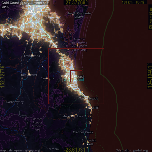

Analysis of Gold Coast night lights 2016
Square area 10x10 km:
 18.94%
90-99
17.99%80-89
4.55%70-79
3.98%60-69
4.92%50-59
1.89%40-49
2.65%30-39
4.73%20-29
15.15%10-19
16.48%0-9
8.71%Square area 50x50 km:
2.81%90-99
2.99%80-89
1.51%70-79
1.22%60-69
4.59%50-59
1.74%40-49
1.84%30-39
1.92%20-29
4.05%10-19
9.97%0-9
67.36%Clear (daylight) street map image can be seen on geolist.org.
Map coordinates:
27° 22' 39.7" South, 152° 43' 39.9" East
28° 0' 1" South, 153° 25' 51.2" East
28° 37' 9.5" South, 154° 8' 2.4" East
Some cities around Gold Coast sort by population:
• Southport
4.9 km =3 mi,  318°
318°
• Surfers Paradise
0.3 km =0.2 mi,  197°
197°
• Mermaid Waters
5.4 km =3.4 mi,  180°
180°
• Benowa
4.5 km =2.8 mi,  259°
259°
• Broadbeach
3.1 km =1.9 mi, 175°
• Broadbeach Waters
3.9 km =2.4 mi,  188°
188°
• Mermaid Beach
4.9 km =3 mi, 175°
• Main Beach
2.4 km =1.5 mi,  350°
350°
2165087 (p: 591,473)
Sources (retrieved 2019-11-25):
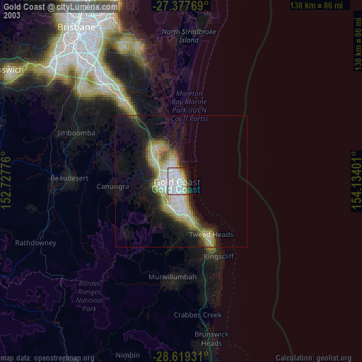
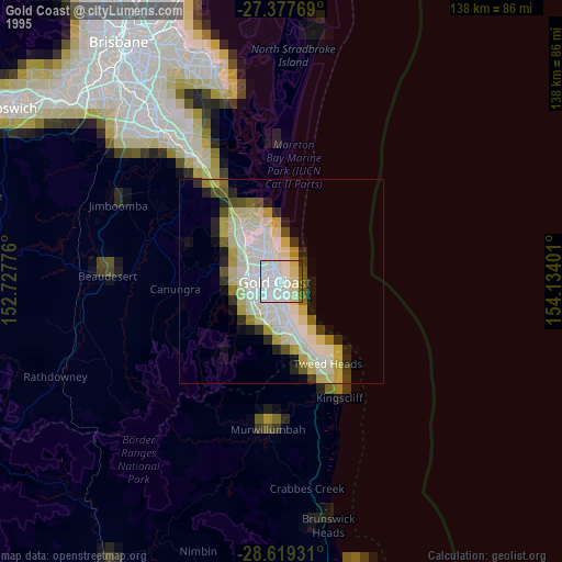
» NASA, Earths city lights 1995
» NASA city lights 2003
» Earth at Night: Flat Maps 2012, 2016