Emerald night lights from space
Night Light of Emerald (Victoria) from space (Australia) Src. Average luminocity for 10x10km area is 1.0211% and for 50x50km: 22.1317%.
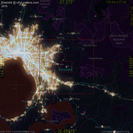
Analysis of Emerald night lights 2016
Square area 10x10 km:
 0%
0%90-99
0%80-89
0%70-79
0%60-69
0.65%50-59
0%40-49
0%30-39
0.65%20-29
0.65%10-19
0%0-9
98.05%Square area 50x50 km:
3.42%90-99
3.79%80-89
1.78%70-79
3.86%60-69
5.29%50-59
4.32%40-49
3.25%30-39
3.02%20-29
3.68%10-19
7.28%0-9
60.31%Clear (daylight) street map image can be seen on geolist.org.
Map coordinates:
37° 22' 30" South, 144° 44' 16.1" East
37° 55' 54" South, 145° 26' 27.3" East
38° 29' 3" South, 146° 8' 38.6" East
Some cities around Emerald sort by population:
• Berwick
13.8 km =8.6 mi,  215°
215°
• Ferntree Gully
13.8 km =8.6 mi,  292°
292°
• Narre Warren North
12.3 km =7.6 mi,  242°
242°
• Officer
14.4 km =8.9 mi,  191°
191°
• Beaconsfield
14.7 km =9.1 mi,  206°
206°
• Montrose
15.1 km =9.4 mi,  328°
328°
• Lysterfield
12.4 km =7.7 mi,  269°
269°
• Upwey
10.1 km =6.3 mi, 290°
2167425 (p: 5,571)
Sources (retrieved 2019-11-25):
» Earth at Night: Flat Maps 2012, 2016