Clontarf night lights from space
Night Light of Clontarf (Queensland) from space (Australia) Src. Average luminocity for 10x10km area is 52.661% and for 50x50km: 25.3013%.
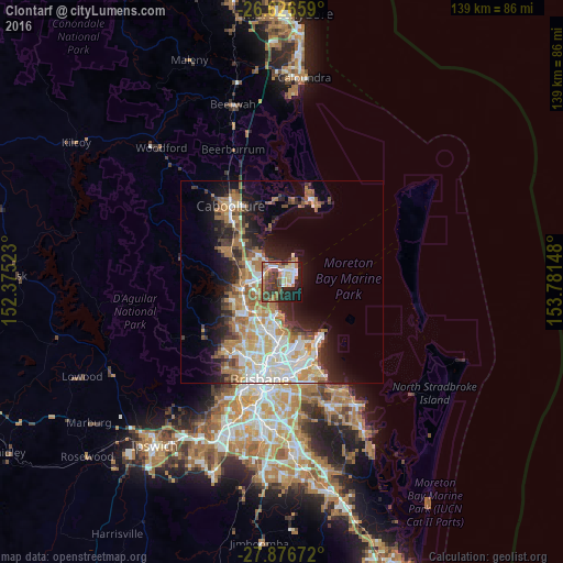
Analysis of Clontarf night lights 2016
Square area 10x10 km:
 7.58%
7.58%90-99
8.71%80-89
8.52%70-79
0.95%60-69
17.42%50-59
5.68%40-49
12.88%30-39
11.55%20-29
9.66%10-19
15.72%0-9
1.33%Square area 50x50 km:
4.87%90-99
5.18%80-89
3.03%70-79
2.28%60-69
6.75%50-59
2.16%40-49
2.66%30-39
3.1%20-29
4.75%10-19
9.56%0-9
55.66%Clear (daylight) street map image can be seen on geolist.org.
Map coordinates:
26° 37' 35.7" South, 152° 22' 30.8" East
27° 15' 12.3" South, 153° 4' 42.1" East
27° 52' 36.2" South, 153° 46' 53.3" East
Some cities around Clontarf sort by population:
• North Lakes
6.6 km =4.1 mi,  299°
299°
• Kippa-Ring
3.1 km =1.9 mi,  9°
9°
• Brighton
5.2 km =3.2 mi,  203°
203°
• Scarborough
6.6 km =4.1 mi,  27°
27°
• Mango Hill
5.5 km =3.4 mi,  281°
281°
• Margate
2.1 km =1.3 mi,  71°
71°
• Rothwell
5.4 km =3.4 mi,  324°
324°
• Griffin
4.3 km =2.7 mi,  242°
242°
7932687 (p: 8,205)
Sources (retrieved 2019-11-25):
» Earth at Night: Flat Maps 2012, 2016