Blackwater night lights from space
Night Light of Blackwater (Queensland) from space (Australia) Src. Average luminocity for 10x10km area is 10.5357% and for 50x50km: 2.1944%.
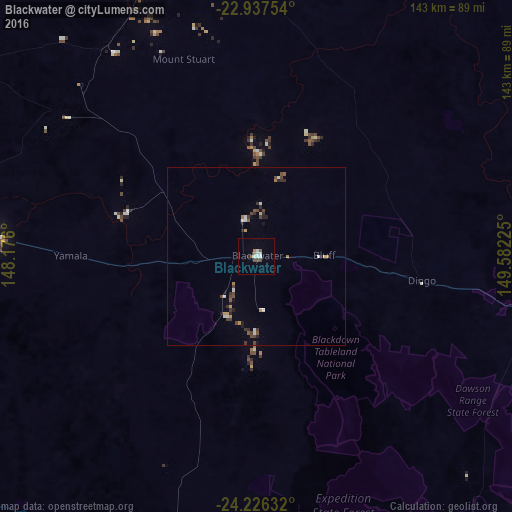
Analysis of Blackwater night lights 2016
Square area 10x10 km:
 2.58%
2.58%90-99
2.18%80-89
0%70-79
0.99%60-69
0.6%50-59
1.59%40-49
2.38%30-39
0%20-29
0.79%10-19
0.2%0-9
88.69%Square area 50x50 km:
0.29%90-99
0.32%80-89
0.07%70-79
0.26%60-69
0.17%50-59
0.27%40-49
0.66%30-39
0.34%20-29
0.42%10-19
0.31%0-9
96.9%Clear (daylight) street map image can be seen on geolist.org.
Map coordinates:
22° 56' 15.1" South, 148° 10' 33.6" East
23° 35' 0.6" South, 148° 52' 44.8" East
24° 13' 34.8" South, 149° 34' 56.1" East
Some cities around Blackwater sort by population:
• Rockhampton
167.4 km =104 mi,  82°
82°
• Emerald
73.8 km =45.9 mi,  275°
275°
• Gracemere
161.7 km =100.5 mi, 84°
• Norman Gardens
170.5 km =105.9 mi, 80°
• Frenchville
171.9 km =106.8 mi, 81°
• Berserker
169.3 km =105.2 mi, 81°
• The Range
166.3 km =103.3 mi, 82°
• Park Avenue
169.2 km =105.1 mi, 81°
2175403 (p: 6,089)
Sources (retrieved 2019-11-25):
» Earth at Night: Flat Maps 2012, 2016