Bicton night lights from space
Night Light of Bicton (Western Australia) from space (Australia) Src. Average luminocity for 10x10km area is 74.3689% and for 50x50km: 40.4745%.
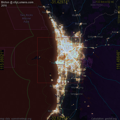
Analysis of Bicton night lights 2016
Square area 10x10 km:
 18.53%
90-99
20.45%80-89
11.01%70-79
8.39%60-69
15.91%50-59
7.87%40-49
7.87%30-39
0.87%20-29
8.04%10-19
1.05%0-9
0%Square area 50x50 km:
9.36%90-99
10%80-89
4.75%70-79
6.21%60-69
7.77%50-59
4.46%40-49
3.31%30-39
3.07%20-29
6.48%10-19
6.16%0-9
38.44%Clear (daylight) street map image can be seen on geolist.org.
Map coordinates:
31° 25' 47.1" South, 115° 4' 48.8" East
32° 1' 40" South, 115° 46' 60" East
32° 37' 19" South, 116° 29' 11.3" East
Some cities around Bicton sort by population:
• Fremantle
4.8 km =3 mi,  228°
228°
• Mosman Park
3.1 km =1.9 mi,  323°
323°
• East Fremantle
1.9 km =1.2 mi, 231°
• Cottesloe
4.4 km =2.7 mi,  327°
327°
• Palmyra
1.9 km =1.2 mi,  172°
172°
• Applecross
4.9 km =3 mi,  75°
75°
• Attadale
1.8 km =1.1 mi, 79°
• Melville
2.2 km =1.4 mi,  129°
129°
2078907 (p: 6,422)
Sources (retrieved 2019-11-25):
» Earth at Night: Flat Maps 2012, 2016