Bentleigh night lights from space
Night Light of Bentleigh (Victoria) from space (Australia) Src. Average luminocity for 10x10km area is 84.3864% and for 50x50km: 52.3504%.
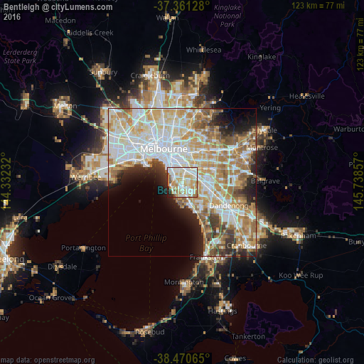
Analysis of Bentleigh night lights 2016
Square area 10x10 km:
 25%
25%90-99
29.22%80-89
11.53%70-79
17.86%60-69
7.14%50-59
3.57%40-49
0.49%30-39
0.65%20-29
3.41%10-19
1.14%0-9
0%Square area 50x50 km:
14.37%90-99
13%80-89
6.67%70-79
9.02%60-69
7.68%50-59
5.72%40-49
3.68%30-39
3.11%20-29
4.74%10-19
5.6%0-9
26.42%Clear (daylight) street map image can be seen on geolist.org.
Map coordinates:
37° 21' 40.6" South, 144° 19' 56.4" East
37° 55' 5" South, 145° 2' 7.6" East
38° 28' 14.3" South, 145° 44' 18.9" East
Some cities around Bentleigh sort by population:
• Brighton
3.2 km =2 mi,  295°
295°
• Carnegie
3.2 km =2 mi,  32°
32°
• Brighton East
2.4 km =1.5 mi,  317°
317°
• Caulfield South
2.6 km =1.6 mi,  341°
341°
• Murrumbeena
3.4 km =2.1 mi,  53°
53°
• Ormond
2 km =1.2 mi,  354°
354°
• Moorabbin
3.3 km =2.1 mi,  143°
143°
• McKinnon
1.3 km =0.8 mi,  83°
83°
2176123 (p: 15,892)
Sources (retrieved 2019-11-25):
» Earth at Night: Flat Maps 2012, 2016