McKinnon night lights from space
Night Light of McKinnon (Victoria) from space (Australia) Src. Average luminocity for 10x10km area is 88.0795% and for 50x50km: 52.4546%.
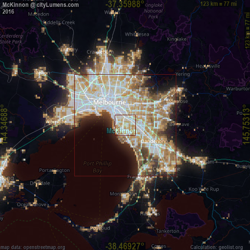
Analysis of McKinnon night lights 2016
Square area 10x10 km:
 26.62%
90-99
30.03%80-89
16.23%70-79
18.02%60-69
5.52%50-59
2.27%40-49
0.16%30-39
0.32%20-29
0.81%10-19
0%0-9
0%Square area 50x50 km:
14.23%90-99
12.82%80-89
6.66%70-79
9.04%60-69
7.78%50-59
5.89%40-49
3.88%30-39
3.26%20-29
4.94%10-19
5.98%0-9
25.51%Clear (daylight) street map image can be seen on geolist.org.
Map coordinates:
37° 21' 35.6" South, 144° 20' 48.8" East
37° 55' 0" South, 145° 3' 0" East
38° 28' 9.4" South, 145° 45' 11.3" East
Some cities around McKinnon sort by population:
• Bentleigh East
0.4 km =0.2 mi,  137°
137°
• Carnegie
2.6 km =1.6 mi,  10°
10°
• Bentleigh
1.3 km =0.8 mi,  263°
263°
• Brighton East
3.3 km =2.1 mi,  299°
299°
• Caulfield South
3.1 km =1.9 mi,  317°
317°
• Murrumbeena
2.4 km =1.5 mi,  38°
38°
• Ormond
2.4 km =1.5 mi, 321°
• Moorabbin
2.8 km =1.7 mi,  166°
166°
2158307 (p: 5,553)
Sources (retrieved 2019-11-25):
» Earth at Night: Flat Maps 2012, 2016