Zillmere night lights from space
Night Light of Zillmere (Queensland) from space (Australia) Src. Average luminocity for 10x10km area is 82.6345% and for 50x50km: 35.2065%.
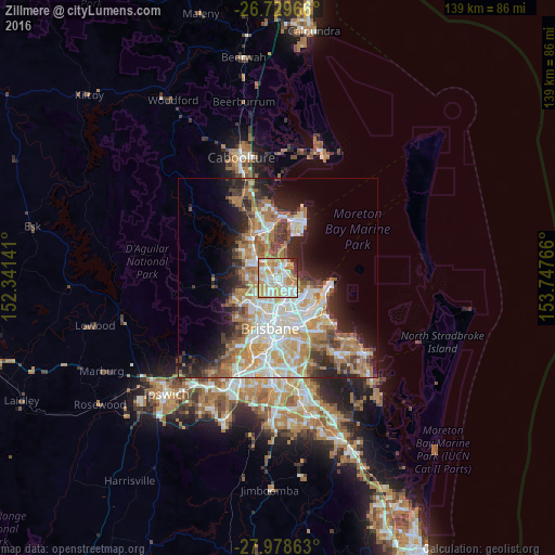
Analysis of Zillmere night lights 2016
Square area 10x10 km:
 19.89%
90-99
23.86%80-89
18.37%70-79
17.23%60-69
13.83%50-59
1.14%40-49
0.76%30-39
2.08%20-29
2.84%10-19
0%0-9
0%Square area 50x50 km:
6.89%90-99
7.68%80-89
4.49%70-79
4.56%60-69
8.85%50-59
2.79%40-49
3.73%30-39
4.15%20-29
6.07%10-19
9.11%0-9
41.68%Clear (daylight) street map image can be seen on geolist.org.
Map coordinates:
26° 43' 46.8" South, 152° 20' 29.1" East
27° 21' 21.3" South, 153° 2' 40.3" East
27° 58' 43.1" South, 153° 44' 51.6" East
Some cities around Zillmere sort by population:
• Aspley
3 km =1.9 mi,  246°
246°
• Chermside
3.5 km =2.2 mi,  203°
203°
• Wavell Heights
4.2 km =2.6 mi,  176°
176°
• Carseldine
2.3 km =1.4 mi,  293°
293°
• Boondall
1.6 km =1 mi,  79°
79°
• Taigum
1.5 km =0.9 mi,  359°
359°
• Chermside West
4.2 km =2.6 mi,  222°
222°
• Fitzgibbon
2.4 km =1.5 mi,  319°
319°
6943555 (p: 8,860)
Sources (retrieved 2019-11-25):
» Earth at Night: Flat Maps 2012, 2016