Arncliffe night lights from space
Night Light of Arncliffe (New South Wales) from space (Australia) Src. Average luminocity for 10x10km area is 91.535% and for 50x50km: 44.5734%.
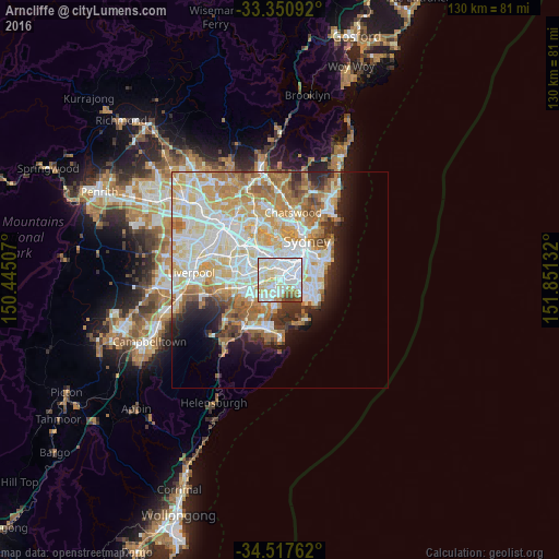
Analysis of Arncliffe night lights 2016
Square area 10x10 km:
 42.83%
90-99
30.77%80-89
12.59%70-79
4.55%60-69
2.8%50-59
4.02%40-49
2.45%30-39
0%20-29
0%10-19
0%0-9
0%Square area 50x50 km:
11.5%90-99
12.28%80-89
6.45%70-79
6.84%60-69
7%50-59
3.6%40-49
2.22%30-39
2.93%20-29
3.73%10-19
5.86%0-9
37.59%Clear (daylight) street map image can be seen on geolist.org.
Map coordinates:
33° 21' 3.3" South, 150° 26' 42.3" East
33° 56' 10.6" South, 151° 8' 53.5" East
34° 31' 3.4" South, 151° 51' 4.8" East
Some cities around Arncliffe sort by population:
• Marrickville
3.3 km =2.1 mi,  11°
11°
• Bexley
3.3 km =2.1 mi,  242°
242°
• Earlwood
2.7 km =1.7 mi,  308°
308°
• Kogarah
3.7 km =2.3 mi,  198°
198°
• Rockdale
2.1 km =1.3 mi,  221°
221°
• Dulwich Hill
3.7 km =2.3 mi,  347°
347°
• Brighton-Le-Sands
2.7 km =1.7 mi,  174°
174°
• Wolli Creek
0.7 km =0.4 mi,  34°
34°
6695559 (p: 10,523)
Sources (retrieved 2019-11-25):
» Earth at Night: Flat Maps 2012, 2016