Feldkirch night lights from space
Night Light of Feldkirch (Vorarlberg) from space (Austria) Src. Average luminocity for 10x10km area is 20.8497% and for 50x50km: 7.5754%.
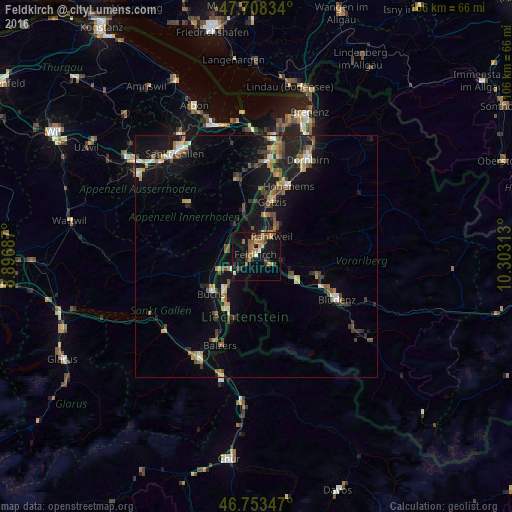

Analysis of Feldkirch night lights 2016
Square area 10x10 km:
 0.6%
0.6%90-99
1.49%80-89
0.74%70-79
5.65%60-69
4.17%50-59
4.02%40-49
3.57%30-39
4.46%20-29
1.49%10-19
22.92%0-9
50.89%Square area 50x50 km:
0.38%90-99
0.89%80-89
0.59%70-79
1.02%60-69
1.34%50-59
1.14%40-49
1.47%30-39
1.23%20-29
1.88%10-19
7.39%0-9
82.68%Clear (daylight) street map image can be seen on geolist.org.
Map coordinates:
47° 42' 30" North, 8° 53' 48.7" East
47° 13' 59" North, 9° 36' 0" East
46° 45' 12.5" North, 10° 18' 11.3" East
Some cities around Feldkirch sort by population:
• Rankweil
5.3 km =3.3 mi,  37°
37°
• Frastanz
2.9 km =1.8 mi,  127°
127°
• Eschen, LI
6.4 km =4 mi,  247°
247°
• Mauren, LI
4.5 km =2.8 mi, 248°
• Ruggell, LI
5.7 km =3.5 mi,  275°
275°
• Gamprin, LI
7 km =4.3 mi,  258°
258°
• Schellenberg, LI
4 km =2.5 mi,  267°
267°
• Planken, LI
6.8 km =4.2 mi,  218°
218°
2779674 (p: 33,420)
Sources (retrieved 2019-11-25):
» Earth at Night: Flat Maps 2012, 2016