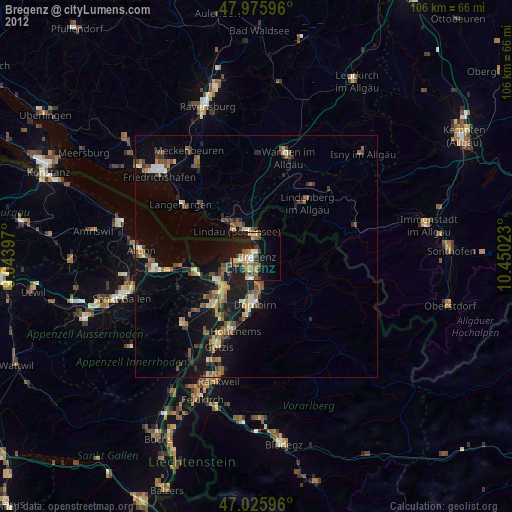
Bregenz night lights from space
Night Light of Bregenz (Vorarlberg) from space (Austria) Src. Average luminocity for 10x10km area is 25.2642% and for 50x50km: 6.723%.
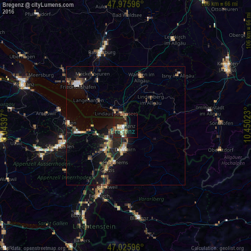
Analysis of Bregenz night lights 2016
Square area 10x10 km:
100  1.99%
1.99%
90-99 4.69%
80-89 2.56%
70-79 3.13%
60-69 3.55%
50-59 5.54%
40-49 3.27%
30-39 1.85%
20-29 7.53%
10-19 30.11%
0-9 35.8%
1.99%90-99
4.69%80-89
2.56%70-79
3.13%60-69
3.55%50-59
5.54%40-49
3.27%30-39
1.85%20-29
7.53%10-19
30.11%0-9
35.8%Square area 50x50 km:
100 0.4%
90-99 0.78%
80-89 0.53%
70-79 0.63%
60-69 1.09%
50-59 1.23%
40-49 1.48%
30-39 1.06%
20-29 1.98%
10-19 6.78%
0-9 84.05%
0.4%90-99
0.78%80-89
0.53%70-79
0.63%60-69
1.09%50-59
1.23%40-49
1.48%30-39
1.06%20-29
1.98%10-19
6.78%0-9
84.05%Clear (daylight) street map image can be seen on geolist.org.
Map coordinates:
47° 58' 33.5" North, 9° 2' 38.3" East
47° 30' 11.2" North, 9° 44' 49.6" East
47° 1' 33.5" North, 10° 27' 0.8" East
Some cities around Bregenz sort by population:
• Dornbirn
9.9 km =6.2 mi,  182°
182°
• Lindau, DE
6.7 km =4.2 mi,  315°
315°
• Hard
5.3 km =3.3 mi,  245°
245°
• Lauterach
3.3 km =2.1 mi,  203°
203°
• Wolfurt
4.1 km =2.5 mi, 176°
• Höchst
9.4 km =5.8 mi,  238°
238°
• Hörbranz
5.2 km =3.2 mi,  2°
2°
• Lochau
3.4 km =2.1 mi, 3°
2781503 (p: 29,471)
Sources (retrieved 2019-11-25):
» Earth at Night: Flat Maps 2012, 2016