Tinogasta night lights from space
Night Light of Tinogasta (Catamarca) from space (Argentina) Src. Average luminocity for 10x10km area is 22.0095% and for 50x50km: 1.157%.
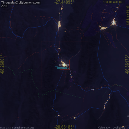
Analysis of Tinogasta night lights 2016
Square area 10x10 km:
 1.52%
1.52%90-99
1.7%80-89
6.06%70-79
3.98%60-69
2.65%50-59
0.95%40-49
4.73%30-39
3.03%20-29
1.52%10-19
13.83%0-9
60.04%Square area 50x50 km:
0.06%90-99
0.07%80-89
0.24%70-79
0.19%60-69
0.14%50-59
0.1%40-49
0.23%30-39
0.27%20-29
0.11%10-19
0.6%0-9
97.99%Clear (daylight) street map image can be seen on geolist.org.
Map coordinates:
27° 26' 27.4" South, 68° 16' 4.8" West
28° 3' 47.5" South, 67° 33' 53.6" West
28° 40' 54.7" South, 66° 51' 42.3" West
Some cities around Tinogasta sort by population:
• San Fernando del Valle de Catamarca
180 km =111.8 mi,  104°
104°
• La Rioja
165.3 km =102.7 mi,  155°
155°
• Chilecito
122.3 km =76 mi,  176°
176°
• Andalgalá
133.9 km =83.2 mi,  66°
66°
• Arauco
95 km =59 mi,  127°
127°
• Fiambalá
43.8 km =27.2 mi,  353°
353°
• Huillapima
171.7 km =106.7 mi,  115°
115°
• Capayán
168.1 km =104.5 mi, 118°
3834361 (p: 14,509)
Sources (retrieved 2019-11-25):
» Earth at Night: Flat Maps 2012, 2016