Santo Tomé night lights from space
Night Light of Santo Tomé (Corrientes) from space (Argentina) Src. Average luminocity for 10x10km area is 26.1553% and for 50x50km: 2.9728%.
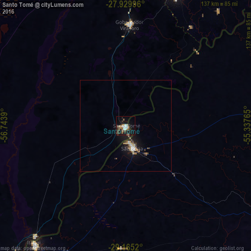
Analysis of Santo Tomé night lights 2016
Square area 10x10 km:
 3.79%
3.79%90-99
3.79%80-89
2.46%70-79
2.08%60-69
3.98%50-59
4.17%40-49
5.11%30-39
2.65%20-29
5.3%10-19
27.27%0-9
39.39%Square area 50x50 km:
0.31%90-99
0.44%80-89
0.37%70-79
0.23%60-69
0.46%50-59
0.31%40-49
0.41%30-39
0.43%20-29
0.4%10-19
3.57%0-9
93.08%Clear (daylight) street map image can be seen on geolist.org.
Map coordinates:
27° 55' 47.9" South, 56° 44' 38" West
28° 32' 57.8" South, 56° 2' 26.8" West
29° 9' 54.7" South, 55° 20' 15.5" West
Some cities around Santo Tomé sort by population:
• São Borja, BR
12.9 km =8 mi,  163°
163°
• Itaqui, BR
81.2 km =50.5 mi,  217°
217°
• São Luiz Gonzaga, BR
106.7 km =66.3 mi,  81°
81°
• Gobernador Virasora
55.5 km =34.5 mi,  0°
0°
• La Cruz
91 km =56.5 mi, 220°
• Alvear
78.5 km =48.8 mi, 219°
• Concepción de la Sierra
81 km =50.3 mi,  38°
38°
• San José
90.3 km =56.1 mi,  16°
16°
3428071 (p: 22,634)
Sources (retrieved 2019-11-25):
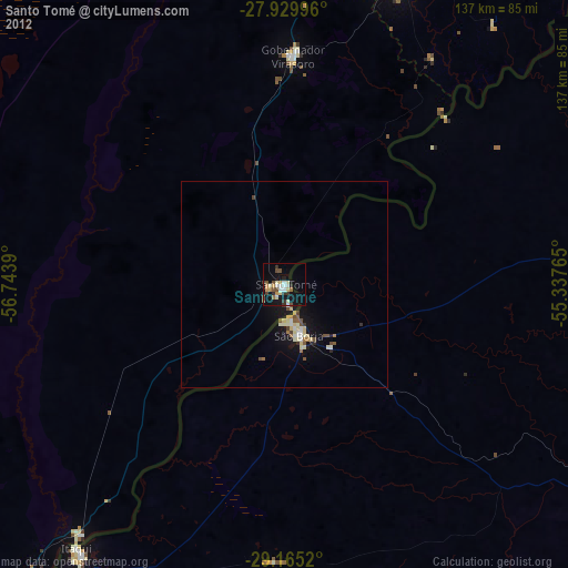
» Earth at Night: Flat Maps 2012, 2016