La Cruz night lights from space
Night Light of La Cruz (Corrientes) from space (Argentina) Src. Average luminocity for 10x10km area is 12.1746% and for 50x50km: 1.8421%.
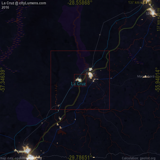
Analysis of La Cruz night lights 2016
Square area 10x10 km:
 1.39%
1.39%90-99
0.99%80-89
2.38%70-79
0.4%60-69
3.17%50-59
1.39%40-49
2.38%30-39
0.6%20-29
0%10-19
1.19%0-9
86.11%Square area 50x50 km:
0.26%90-99
0.21%80-89
0.33%70-79
0.18%60-69
0.21%50-59
0.15%40-49
0.18%30-39
0.17%20-29
0.18%10-19
1.55%0-9
96.57%Clear (daylight) street map image can be seen on geolist.org.
Map coordinates:
28° 33' 31.2" South, 57° 20' 47" West
29° 10' 27.9" South, 56° 38' 35.7" West
29° 47' 11.4" South, 55° 56' 24.5" West
Some cities around La Cruz sort by population:
• Uruguaiana, BR
77.6 km =48.2 mi,  213°
213°
• Alegrete, BR
106.6 km =66.2 mi,  129°
129°
• São Borja, BR
84.4 km =52.4 mi,  47°
47°
• Paso de los Libres
73.7 km =45.8 mi,  215°
215°
• Itaqui, BR
10.3 km =6.4 mi,  58°
58°
• Quaraí, BR
136.1 km =84.6 mi,  172°
172°
• Santo Tomé
91 km =56.5 mi,  40°
40°
• Alvear
12.5 km =7.8 mi, 46°
3432760 (p: 8,591)
Sources (retrieved 2019-11-25):
» Earth at Night: Flat Maps 2012, 2016