Santa Rosa de Calamuchita night lights from space
Night Light of Santa Rosa de Calamuchita (Cordoba) from space (Argentina) Src. Average luminocity for 10x10km area is 20.8846% and for 50x50km: 3.9918%.
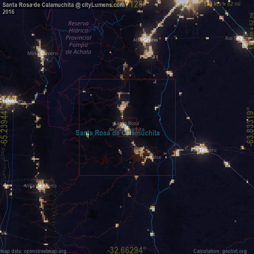
Analysis of Santa Rosa de Calamuchita night lights 2016
Square area 10x10 km:
 0.87%
0.87%90-99
2.45%80-89
2.97%70-79
1.4%60-69
4.37%50-59
4.55%40-49
3.32%30-39
3.32%20-29
2.45%10-19
22.2%0-9
52.1%Square area 50x50 km:
0.08%90-99
0.2%80-89
0.43%70-79
0.52%60-69
1.2%50-59
0.55%40-49
0.65%30-39
1.06%20-29
0.46%10-19
2.73%0-9
92.13%Clear (daylight) street map image can be seen on geolist.org.
Map coordinates:
31° 28' 16.6" South, 65° 14' 22" West
32° 4' 8.6" South, 64° 32' 10.7" West
32° 39' 46.6" South, 63° 49' 59.5" West
Some cities around Santa Rosa de Calamuchita sort by population:
• Río Tercero
41.4 km =25.7 mi,  106°
106°
• Alta Gracia
47.4 km =29.5 mi,  12°
12°
• Embalse
16.6 km =10.3 mi,  137°
137°
• Merlo
54.3 km =33.7 mi,  235°
235°
• Almafuerte
29.8 km =18.5 mi,  117°
117°
• Berrotarán
44.7 km =27.8 mi,  161°
161°
• Villa General Belgrano
10.3 km =6.4 mi,  349°
349°
• Despeñaderos
36.5 km =22.7 mi,  39°
39°
3835943 (p: 9,504)
Sources (retrieved 2019-11-25):
» Earth at Night: Flat Maps 2012, 2016