Despeñaderos night lights from space
Night Light of Despeñaderos (Cordoba) from space (Argentina) Src. Average luminocity for 10x10km area is 6.7674% and for 50x50km: 4.5151%.
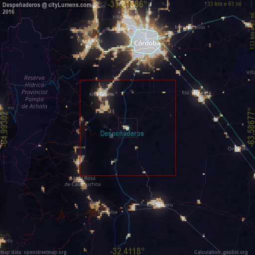
Analysis of Despeñaderos night lights 2016
Square area 10x10 km:
 0.37%
0.37%90-99
1.1%80-89
1.47%70-79
1.28%60-69
2.2%50-59
0.18%40-49
0%30-39
0.73%20-29
0.73%10-19
0.55%0-9
91.39%Square area 50x50 km:
0.27%90-99
0.36%80-89
0.9%70-79
0.72%60-69
0.54%50-59
0.56%40-49
0.47%30-39
1.2%20-29
0.92%10-19
4.09%0-9
89.97%Clear (daylight) street map image can be seen on geolist.org.
Map coordinates:
31° 13' 0.7" South, 64° 59' 34.9" West
31° 48' 58.5" South, 64° 17' 23.6" West
32° 24' 42.5" South, 63° 35' 12.4" West
Some cities around Despeñaderos sort by population:
• Alta Gracia
22.4 km =13.9 mi,  324°
324°
• Río Segundo
40.3 km =25 mi,  63°
63°
• Embalse
42.2 km =26.2 mi,  196°
196°
• Pilar
41.7 km =25.9 mi,  68°
68°
• Almafuerte
42 km =26.1 mi,  175°
175°
• Santa Rosa de Calamuchita
36.5 km =22.7 mi,  219°
219°
• Malagueño
39.6 km =24.6 mi,  350°
350°
• Villa General Belgrano
30.9 km =19.2 mi,  234°
234°
3859429 (p: 5,645)
Sources (retrieved 2019-11-25):
» Earth at Night: Flat Maps 2012, 2016