Almafuerte night lights from space
Night Light of Almafuerte (Cordoba) from space (Argentina) Src. Average luminocity for 10x10km area is 12.3794% and for 50x50km: 4.0697%.
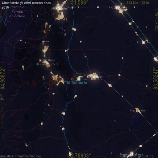
Analysis of Almafuerte night lights 2016
Square area 10x10 km:
 0.7%
0.7%90-99
2.1%80-89
2.45%70-79
0.35%60-69
2.8%50-59
1.05%40-49
1.4%30-39
2.1%20-29
2.1%10-19
0.7%0-9
84.27%Square area 50x50 km:
0.3%90-99
0.34%80-89
0.56%70-79
0.39%60-69
1.14%50-59
0.35%40-49
0.6%30-39
0.58%20-29
0.45%10-19
2.92%0-9
92.38%Clear (daylight) street map image can be seen on geolist.org.
Map coordinates:
31° 35' 45.6" South, 64° 57' 31.4" West
32° 11' 34.7" South, 64° 15' 20.1" West
32° 47' 9.7" South, 63° 33' 8.9" West
Some cities around Almafuerte sort by population:
• Río Tercero
13.5 km =8.4 mi,  80°
80°
• Embalse
15.4 km =9.6 mi,  275°
275°
• Hernando
55.5 km =34.5 mi,  117°
117°
• Santa Rosa de Calamuchita
29.8 km =18.5 mi,  297°
297°
• Berrotarán
31.3 km =19.4 mi,  203°
203°
• Villa General Belgrano
37 km =23 mi,  310°
310°
• Despeñaderos
42 km =26.1 mi,  355°
355°
• Tancacha
26.5 km =16.5 mi,  102°
102°
3866237 (p: 10,534)
Sources (retrieved 2019-11-25):
» Earth at Night: Flat Maps 2012, 2016