Merlo night lights from space
Night Light of Merlo (San Luis) from space (Argentina) Src. Average luminocity for 10x10km area is 28.7271% and for 50x50km: 2.7985%.
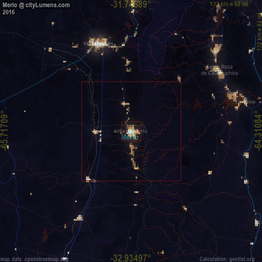
Analysis of Merlo night lights 2016
Square area 10x10 km:
 2.38%
2.38%90-99
2.93%80-89
4.03%70-79
6.78%60-69
6.59%50-59
1.47%40-49
3.3%30-39
5.13%20-29
2.2%10-19
33.15%0-9
32.05%Square area 50x50 km:
0.16%90-99
0.2%80-89
0.42%70-79
0.47%60-69
0.58%50-59
0.37%40-49
0.4%30-39
0.63%20-29
0.21%10-19
1.77%0-9
94.79%Clear (daylight) street map image can be seen on geolist.org.
Map coordinates:
31° 44' 48.8" South, 65° 43' 1.5" West
32° 20' 34.4" South, 65° 0' 50.3" West
32° 56' 5.9" South, 64° 18' 39" West
Some cities around Merlo sort by population:
• Villa Dolores
47.1 km =29.3 mi,  339°
339°
• Embalse
58.9 km =36.6 mi,  72°
72°
• Almafuerte
73.2 km =45.5 mi,  76°
76°
• Santa Rosa de Calamuchita
54.3 km =33.7 mi,  55°
55°
• Mina Clavero
69.1 km =42.9 mi,  0°
0°
• Berrotarán
59.9 km =37.2 mi,  101°
101°
• Villa General Belgrano
59.2 km =36.8 mi,  46°
46°
• Tilisarao
50.6 km =31.4 mi,  210°
210°
3844377 (p: 11,159)
Sources (retrieved 2019-11-25):
» Earth at Night: Flat Maps 2012, 2016