San Lorenzo night lights from space
Night Light of San Lorenzo (Corrientes) from space (Argentina) Src. Average luminocity for 10x10km area is 2.1023% and for 50x50km: 1.0986%.
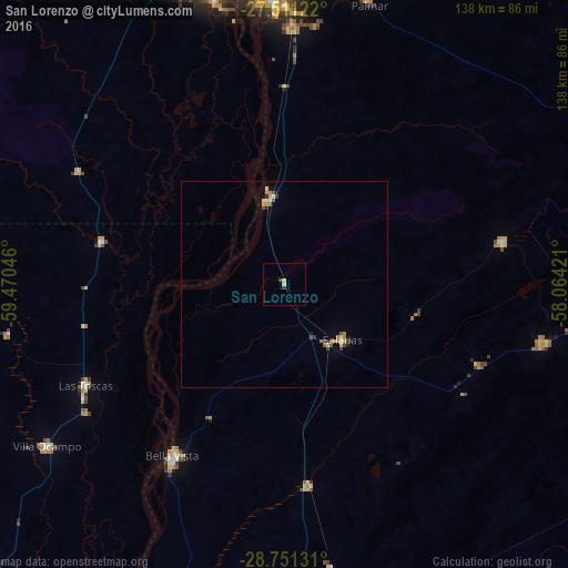
Analysis of San Lorenzo night lights 2016
Square area 10x10 km:
 0%
0%90-99
0%80-89
1.52%70-79
0%60-69
0%50-59
0%40-49
0.76%30-39
0.76%20-29
0%10-19
0%0-9
96.97%Square area 50x50 km:
0.06%90-99
0.07%80-89
0.28%70-79
0.16%60-69
0.19%50-59
0.13%40-49
0.17%30-39
0.2%20-29
0.12%10-19
0.11%0-9
98.51%Clear (daylight) street map image can be seen on geolist.org.
Map coordinates:
27° 30' 40.4" South, 59° 28' 13.7" West
28° 7' 59" South, 58° 46' 2.4" West
28° 45' 4.7" South, 58° 3' 51.2" West
Some cities around San Lorenzo sort by population:
• Corrientes
74.3 km =46.2 mi,  354°
354°
• Barranqueras
74.4 km =46.2 mi, 346°
• Villa Ocampo
69.7 km =43.3 mi,  235°
235°
• Saladas
19.3 km =12 mi,  134°
134°
• Las Toscas
53.9 km =33.5 mi, 243°
• Mburucuyá
53.8 km =33.4 mi,  79°
79°
• Puerto Vilelas
70.9 km =44.1 mi, 346°
• Santa Rosa
65.2 km =40.5 mi,  102°
102°
3428759 (p: 47,626)
Sources (retrieved 2019-11-25):
» Earth at Night: Flat Maps 2012, 2016