Presidencia Roque Sáenz Peña night lights from space
Night Light of Presidencia Roque Sáenz Peña (Chaco) from space (Argentina) Src. Average luminocity for 10x10km area is 55.9643% and for 50x50km: 3.9326%.
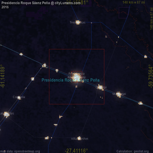
Analysis of Presidencia Roque Sáenz Peña night lights 2016
Square area 10x10 km:
 13.89%
90-99
12.7%80-89
7.54%70-79
9.33%60-69
3.57%50-59
4.76%40-49
7.14%30-39
6.75%20-29
10.91%10-19
22.22%0-9
1.19%Square area 50x50 km:
0.7%90-99
0.61%80-89
0.51%70-79
0.48%60-69
0.37%50-59
0.33%40-49
0.51%30-39
0.44%20-29
0.74%10-19
3.06%0-9
92.26%Clear (daylight) street map image can be seen on geolist.org.
Map coordinates:
26° 9' 20.9" South, 61° 8' 30.8" West
26° 47' 6.8" South, 60° 26' 19.5" West
27° 24' 40.2" South, 59° 44' 8.3" West
Some cities around Presidencia Roque Sáenz Peña sort by population:
• Quitilipi
23.9 km =14.9 mi,  112°
112°
• Machagai
41.7 km =25.9 mi, 112°
• Tres Isletas
49.4 km =30.7 mi,  0°
0°
• Villa Berthet
56.4 km =35 mi,  177°
177°
• Campo Largo
40.1 km =24.9 mi,  267°
267°
• Corzuela
55.9 km =34.7 mi,  250°
250°
• Aviá Terai
30.9 km =19.2 mi,  291°
291°
• Concepción del Bermejo
54.5 km =33.9 mi, 292°
3840300 (p: 81,879)
Sources (retrieved 2019-11-25):
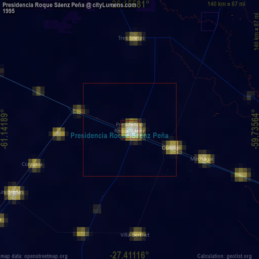
» NASA, Earths city lights 1995
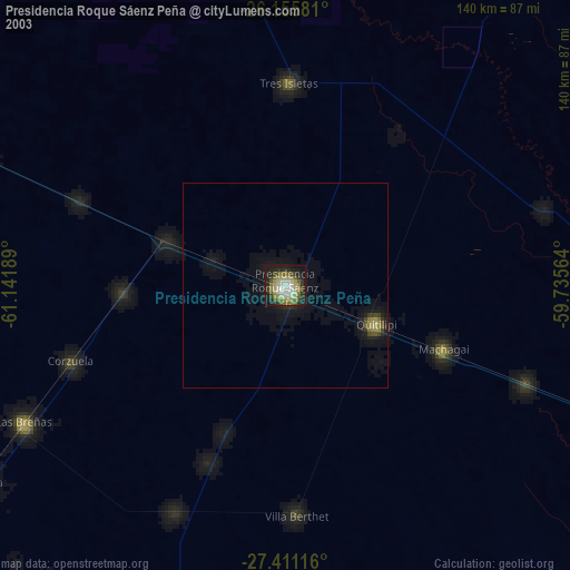
» NASA city lights 2003
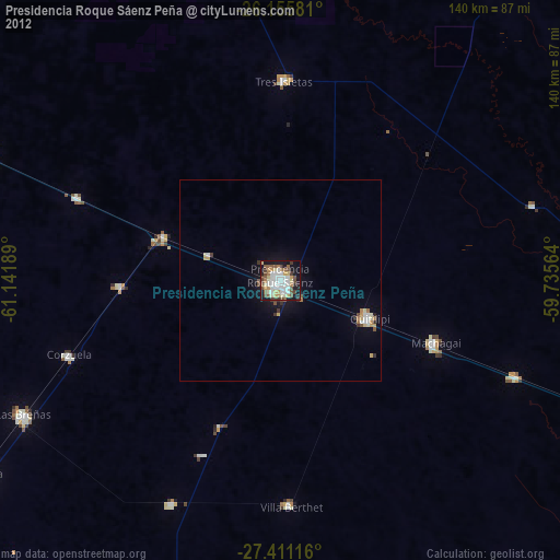
» Earth at Night: Flat Maps 2012, 2016