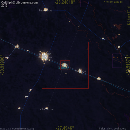
Quitilipi night lights from space
Night Light of Quitilipi (Chaco) from space (Argentina) Src. Average luminocity for 10x10km area is 20.6964% and for 50x50km: 4.2496%.
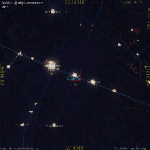
Analysis of Quitilipi night lights 2016
Square area 10x10 km:
 3.37%
3.37%90-99
2.38%80-89
4.76%70-79
2.38%60-69
3.57%50-59
0.2%40-49
1.79%30-39
1.59%20-29
1.79%10-19
9.52%0-9
68.65%Square area 50x50 km:
0.77%90-99
0.7%80-89
0.7%70-79
0.44%60-69
0.38%50-59
0.3%40-49
0.51%30-39
0.49%20-29
0.57%10-19
2.64%0-9
92.49%Clear (daylight) street map image can be seen on geolist.org.
Map coordinates:
26° 14' 24.6" South, 60° 55' 11.9" West
26° 52' 8.9" South, 60° 13' 0.6" West
27° 29' 40.6" South, 59° 30' 49.4" West
Some cities around Quitilipi sort by population:
• Presidencia Roque Sáenz Peña
23.9 km =14.9 mi,  292°
292°
• Machagai
17.8 km =11.1 mi,  110°
110°
• Tres Isletas
62.5 km =38.8 mi,  339°
339°
• Presidencia de la Plaza
39.9 km =24.8 mi, 111°
• Villa Berthet
50.8 km =31.6 mi,  202°
202°
• San Bernardo
67.6 km =42 mi,  226°
226°
• Campo Largo
62.5 km =38.8 mi,  276°
276°
• Aviá Terai
54.8 km =34.1 mi, 291°
3839490 (p: 32,083)
Sources (retrieved 2019-11-25):
» Earth at Night: Flat Maps 2012, 2016