Pampa del Indio night lights from space
Night Light of Pampa del Indio (Chaco) from space (Argentina) Src. Average luminocity for 10x10km area is 7.0774% and for 50x50km: 0.2822%.
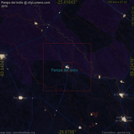
Analysis of Pampa del Indio night lights 2016
Square area 10x10 km:
 0.4%
0.4%90-99
1.19%80-89
0.79%70-79
0.99%60-69
2.18%50-59
0%40-49
1.59%30-39
1.59%20-29
0.79%10-19
0.79%0-9
89.68%Square area 50x50 km:
0.02%90-99
0.05%80-89
0.03%70-79
0.04%60-69
0.09%50-59
0%40-49
0.06%30-39
0.06%20-29
0.03%10-19
0.03%0-9
99.6%Clear (daylight) street map image can be seen on geolist.org.
Map coordinates:
25° 24' 59.1" South, 60° 38' 25.5" West
26° 2' 59.4" South, 59° 56' 14.2" West
26° 40' 47.3" South, 59° 14' 3" West
Some cities around Pampa del Indio sort by population:
• Castelli
69.1 km =42.9 mi,  279°
279°
• General José de San Martín
80.4 km =50 mi,  132°
132°
• Tres Isletas
59 km =36.7 mi,  236°
236°
• Pirané
90.1 km =56 mi,  66°
66°
• El Colorado
63.2 km =39.3 mi,  117°
117°
• Ibarreta
93.2 km =57.9 mi,  4°
4°
• Comandante Fontana
83.5 km =51.9 mi,  17°
17°
• Palo Santo
80.8 km =50.2 mi,  47°
47°
3430180 (p: 11,588)
Sources (retrieved 2019-11-25):
» Earth at Night: Flat Maps 2012, 2016