Santa Fe night lights from space
Night Light of Santa Fe from space (Argentina) Src. Average luminocity for 10x10km area is 72.3864% and for 50x50km: 20.6086%.
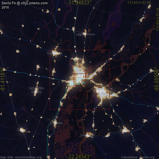
Analysis of Santa Fe night lights 2016
Square area 10x10 km:
 21.61%
90-99
19.41%80-89
4.4%70-79
6.23%60-69
15.75%50-59
10.81%40-49
10.26%30-39
3.48%20-29
5.86%10-19
2.2%0-9
0%Square area 50x50 km:
3.66%90-99
3.1%80-89
2.68%70-79
2.46%60-69
3.26%50-59
2.27%40-49
2.5%30-39
3.33%20-29
5.42%10-19
12.29%0-9
59.03%Clear (daylight) street map image can be seen on geolist.org.
Map coordinates:
31° 2' 54" South, 61° 24' 42.5" West
31° 38' 55.7" South, 60° 42' 31.2" West
32° 14' 43.5" South, 60° 0' 20" West
Some cities around Santa Fe sort by population:
• Paraná
19.4 km =12.1 mi,  118°
118°
• Santo Tomé
5.6 km =3.5 mi,  253°
253°
• Esperanza
30.7 km =19.1 mi,  316°
316°
• Coronda
41.2 km =25.6 mi,  208°
208°
• Recreo
17.7 km =11 mi,  352°
352°
• Laguna Paiva
38.6 km =24 mi,  7°
7°
• San Carlos Centro
37.3 km =23.2 mi,  256°
256°
• San Benito
29.4 km =18.3 mi, 120°
3836277 (p: 489,505)
Sources (retrieved 2019-11-25):
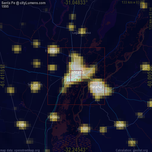
» NASA, Earths city lights 1995
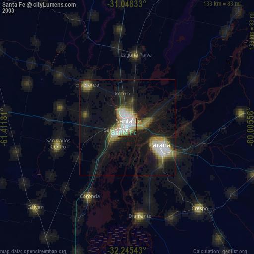
» NASA city lights 2003
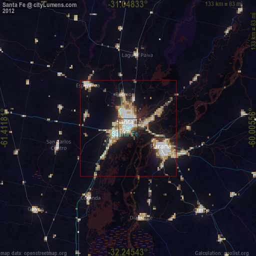
» Earth at Night: Flat Maps 2012, 2016