Paraná night lights from space
Night Light of Paraná (Entre Rios) from space (Argentina) Src. Average luminocity for 10x10km area is 67.4121% and for 50x50km: 18.16%.
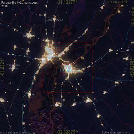

Analysis of Paraná night lights 2016
Square area 10x10 km:
 29.3%
29.3%90-99
16.3%80-89
7.69%70-79
2.93%60-69
3.3%50-59
2.38%40-49
3.66%30-39
9.16%20-29
17.03%10-19
8.24%0-9
0%Square area 50x50 km:
3.46%90-99
2.75%80-89
2.23%70-79
1.96%60-69
2.97%50-59
2.05%40-49
2.52%30-39
2.96%20-29
4.94%10-19
10.21%0-9
63.93%Clear (daylight) street map image can be seen on geolist.org.
Map coordinates:
31° 7' 58" South, 61° 13' 55.6" West
31° 43' 57.8" South, 60° 31' 44.3" West
32° 19' 43.6" South, 59° 49' 33.1" West
Some cities around Paraná sort by population:
• Santa Fe
19.4 km =12.1 mi,  298°
298°
• Santo Tomé
23.7 km =14.7 mi,  289°
289°
• Diamante
38.5 km =23.9 mi,  195°
195°
• Crespo
39 km =24.2 mi,  147°
147°
• Coronda
45.5 km =28.3 mi,  234°
234°
• Recreo
33.1 km =20.6 mi,  324°
324°
• Laguna Paiva
49.2 km =30.6 mi,  345°
345°
• San Benito
10 km =6.2 mi,  124°
124°
3841956 (p: 262,295)
Sources (retrieved 2019-11-25):
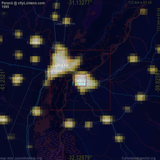
» NASA, Earths city lights 1995
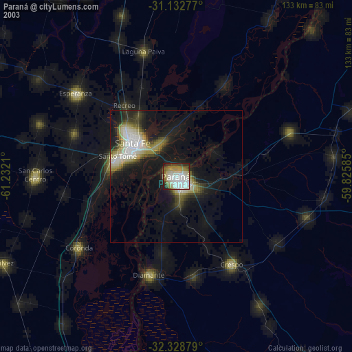
» NASA city lights 2003
» Earth at Night: Flat Maps 2012, 2016