Laboulaye night lights from space
Night Light of Laboulaye (Cordoba) from space (Argentina) Src. Average luminocity for 10x10km area is 13.873% and for 50x50km: 0.697%.
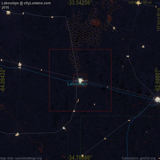

Analysis of Laboulaye night lights 2016
Square area 10x10 km:
 2.65%
2.65%90-99
2.29%80-89
2.12%70-79
2.12%60-69
1.41%50-59
1.23%40-49
0.18%30-39
1.41%20-29
0.35%10-19
1.41%0-9
84.83%Square area 50x50 km:
0.11%90-99
0.09%80-89
0.09%70-79
0.11%60-69
0.13%50-59
0.06%40-49
0.04%30-39
0.09%20-29
0.01%10-19
0.06%0-9
99.22%Clear (daylight) street map image can be seen on geolist.org.
Map coordinates:
33° 32' 33.3" South, 64° 5' 39.6" West
34° 7' 35.8" South, 63° 23' 28.3" West
34° 42' 24" South, 62° 41' 17.1" West
Some cities around Laboulaye sort by population:
• Rufino
64.4 km =40 mi,  104°
104°
• General Villegas
106.6 km =66.2 mi,  161°
161°
• La Carlota
79.1 km =49.2 mi,  6°
6°
• Vicuña Mackenna
95.1 km =59.1 mi,  284°
284°
• Canals
77.7 km =48.3 mi,  36°
36°
• Arias
105.8 km =65.7 mi,  59°
59°
• Adelia María
80.1 km =49.8 mi,  313°
313°
• General Levalle
50.6 km =31.4 mi, 284°
3852468 (p: 19,908)
Sources (retrieved 2019-11-25):
» Earth at Night: Flat Maps 2012, 2016