Canals night lights from space
Night Light of Canals (Cordoba) from space (Argentina) Src. Average luminocity for 10x10km area is 8.1081% and for 50x50km: 0.5822%.
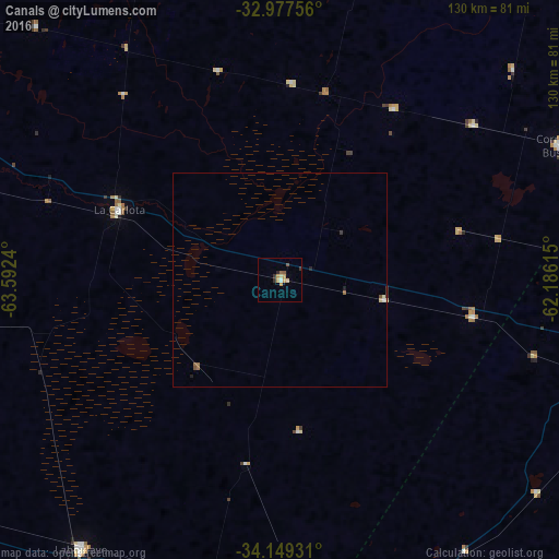
Analysis of Canals night lights 2016
Square area 10x10 km:
 0.73%
0.73%90-99
0%80-89
1.47%70-79
3.66%60-69
0%50-59
1.47%40-49
0.73%30-39
1.47%20-29
1.1%10-19
0%0-9
89.38%Square area 50x50 km:
0.05%90-99
0.02%80-89
0.12%70-79
0.14%60-69
0.02%50-59
0.15%40-49
0.09%30-39
0.12%20-29
0.12%10-19
0.04%0-9
99.14%Clear (daylight) street map image can be seen on geolist.org.
Map coordinates:
32° 58' 39.2" South, 63° 35' 32.6" West
33° 33' 55.5" South, 62° 53' 21.4" West
34° 8' 57.5" South, 62° 11' 10.1" West
Some cities around Canals sort by population:
• Laboulaye
77.7 km =48.3 mi,  216°
216°
• Rufino
79.8 km =49.6 mi,  168°
168°
• La Carlota
41.2 km =25.6 mi,  293°
293°
• Corral de Bustos
72.6 km =45.1 mi,  64°
64°
• Justiniano Posse
78.3 km =48.7 mi,  14°
14°
• Arias
45.9 km =28.5 mi,  100°
100°
• Monte Maíz
48.2 km =30 mi,  33°
33°
• Laborde
45.9 km =28.5 mi,  3°
3°
3862883 (p: 8,343)
Sources (retrieved 2019-11-25):
» Earth at Night: Flat Maps 2012, 2016