La Leonesa night lights from space
Night Light of La Leonesa (Chaco) from space (Argentina) Src. Average luminocity for 10x10km area is 15.8929% and for 50x50km: 1.0902%.
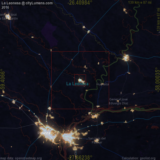
Analysis of La Leonesa night lights 2016
Square area 10x10 km:
 2.98%
2.98%90-99
2.58%80-89
0.79%70-79
2.58%60-69
2.98%50-59
1.39%40-49
0.99%30-39
1.59%20-29
2.78%10-19
2.18%0-9
79.17%Square area 50x50 km:
0.11%90-99
0.1%80-89
0.14%70-79
0.13%60-69
0.19%50-59
0.14%40-49
0.22%30-39
0.24%20-29
0.16%10-19
0.14%0-9
98.44%Clear (daylight) street map image can be seen on geolist.org.
Map coordinates:
26° 24' 35.4" South, 59° 24' 23.8" West
27° 2' 16.3" South, 58° 42' 12.5" West
27° 39' 44.6" South, 58° 0' 1.3" West
Some cities around La Leonesa sort by population:
• Corrientes
49.5 km =30.8 mi,  195°
195°
• Pilar, PY
44.1 km =27.4 mi,  63°
63°
• Fontana
52.8 km =32.8 mi,  216°
216°
• San Luis del Palmar
54.3 km =33.7 mi,  164°
164°
• Puerto Tirol
52.8 km =32.8 mi,  225°
225°
• Itatí
52.2 km =32.4 mi,  119°
119°
• Paso de la Patria
33.6 km =20.9 mi, 157°
• Margarita Belén
36.4 km =22.6 mi, 226°
3432355 (p: 10,067)
Sources (retrieved 2019-11-25):
» Earth at Night: Flat Maps 2012, 2016