San Luis del Palmar night lights from space
Night Light of San Luis del Palmar (Corrientes) from space (Argentina) Src. Average luminocity for 10x10km area is 8.6052% and for 50x50km: 6.8279%.
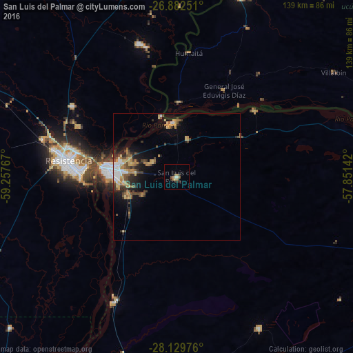
Analysis of San Luis del Palmar night lights 2016
Square area 10x10 km:
 0.6%
0.6%90-99
0.99%80-89
0.6%70-79
1.59%60-69
3.17%50-59
0.2%40-49
0.79%30-39
2.18%20-29
1.79%10-19
0.99%0-9
87.1%Square area 50x50 km:
0.83%90-99
0.61%80-89
1.04%70-79
1.2%60-69
1.28%50-59
0.65%40-49
1.49%30-39
0.97%20-29
1.55%10-19
3.28%0-9
87.12%Clear (daylight) street map image can be seen on geolist.org.
Map coordinates:
26° 52' 57" South, 59° 15' 27.6" West
27° 30' 28.4" South, 58° 33' 16.3" West
28° 7' 47.1" South, 57° 51' 5.1" West
Some cities around San Luis del Palmar sort by population:
• Resistencia
42.7 km =26.5 mi,  277°
277°
• Corrientes
28 km =17.4 mi, 279°
• Barranqueras
38.1 km =23.7 mi,  274°
274°
• Fontana
47.4 km =29.5 mi, 282°
• Puerto Vilelas
37.9 km =23.5 mi, 268°
• Itatí
40.4 km =25.1 mi,  49°
49°
• Paso de la Patria
21.3 km =13.2 mi,  355°
355°
• Margarita Belén
49.5 km =30.8 mi,  303°
303°
3428708 (p: 15,347)
Sources (retrieved 2019-11-25):
» Earth at Night: Flat Maps 2012, 2016