Itatí night lights from space
Night Light of Itatí (Corrientes) from space (Argentina) Src. Average luminocity for 10x10km area is 4.8769% and for 50x50km: 0.4884%.
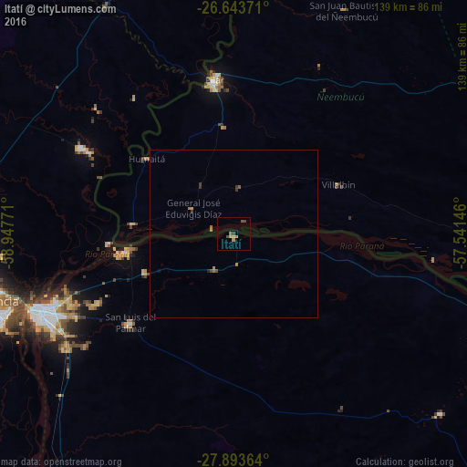
Analysis of Itatí night lights 2016
Square area 10x10 km:
 0%
0%90-99
0%80-89
1.33%70-79
1.14%60-69
1.33%50-59
0.57%40-49
0.95%30-39
1.52%20-29
0%10-19
0%0-9
93.18%Square area 50x50 km:
0%90-99
0%80-89
0.05%70-79
0.11%60-69
0.19%50-59
0.07%40-49
0.1%30-39
0.21%20-29
0.02%10-19
0.02%0-9
99.23%Clear (daylight) street map image can be seen on geolist.org.
Map coordinates:
26° 38' 37.4" South, 58° 56' 51.8" West
27° 16' 13.5" South, 58° 14' 40.5" West
27° 53' 37.1" South, 57° 32' 29.3" West
Some cities around Itatí sort by population:
• Corrientes
62.2 km =38.6 mi,  249°
249°
• Barranqueras
72.5 km =45 mi, 251°
• Pilar, PY
46.2 km =28.7 mi,  352°
352°
• San Luis del Palmar
40.4 km =25.1 mi,  229°
229°
• La Leonesa
52.2 km =32.4 mi,  299°
299°
• Puerto Vilelas
73.7 km =45.8 mi, 248°
• Paso de la Patria
32.8 km =20.4 mi,  260°
260°
• Margarita Belén
71.9 km =44.7 mi,  270°
270°
3433363 (p: 7,902)
Sources (retrieved 2019-11-25):
» Earth at Night: Flat Maps 2012, 2016