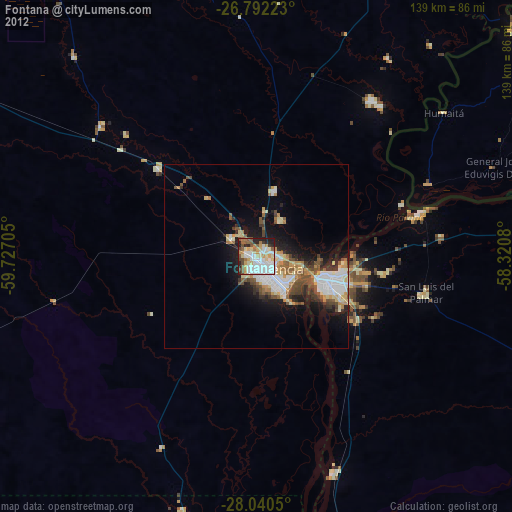
Fontana night lights from space
Night Light of Fontana (Chaco) from space (Argentina) Src. Average luminocity for 10x10km area is 72.6496% and for 50x50km: 14.358%.
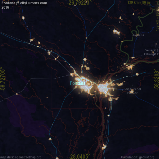
Analysis of Fontana night lights 2016
Square area 10x10 km:
 26.33%
90-99
15.53%80-89
8.52%70-79
13.26%60-69
5.68%50-59
1.7%40-49
7.77%30-39
8.33%20-29
12.69%10-19
0.19%0-9
0%Square area 50x50 km:
3.59%90-99
2.13%80-89
1.41%70-79
2.06%60-69
1.56%50-59
1.05%40-49
2.6%30-39
2.17%20-29
3.82%10-19
6.58%0-9
73.02%Clear (daylight) street map image can be seen on geolist.org.
Map coordinates:
26° 47' 32" South, 59° 43' 37.4" West
27° 25' 5.3" South, 59° 1' 26.1" West
28° 2' 25.8" South, 58° 19' 14.9" West
Some cities around Fontana sort by population:
• Resistencia
6.2 km =3.9 mi,  140°
140°
• Corrientes
19.5 km =12.1 mi,  106°
106°
• Barranqueras
10.9 km =6.8 mi,  130°
130°
• San Luis del Palmar
47.4 km =29.5 mi,  102°
102°
• Puerto Tirol
7.7 km =4.8 mi,  311°
311°
• Puerto Vilelas
13.6 km =8.5 mi, 141°
• Paso de la Patria
46 km =28.6 mi,  75°
75°
• Margarita Belén
18.1 km =11.2 mi,  16°
16°
3433901 (p: 26,745)
Sources (retrieved 2019-11-25):
» Earth at Night: Flat Maps 2012, 2016