Icaño night lights from space
Night Light of Icaño (Catamarca) from space (Argentina) Src. Average luminocity for 10x10km area is 3.3651% and for 50x50km: 0.3953%.
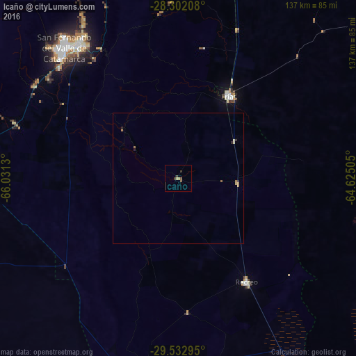
Analysis of Icaño night lights 2016
Square area 10x10 km:
 0%
0%90-99
0%80-89
0.79%70-79
0.79%60-69
0%50-59
1.59%40-49
0.4%30-39
1.98%20-29
0%10-19
0%0-9
94.44%Square area 50x50 km:
0%90-99
0%80-89
0.12%70-79
0.12%60-69
0.09%50-59
0.06%40-49
0.02%30-39
0.11%20-29
0.11%10-19
0%0-9
99.37%Clear (daylight) street map image can be seen on geolist.org.
Map coordinates:
28° 18' 7.5" South, 66° 1' 52.7" West
28° 55' 9.6" South, 65° 19' 41.4" West
29° 31' 58.6" South, 64° 37' 30.2" West
Some cities around Icaño sort by population:
• San Fernando del Valle de Catamarca
67 km =41.6 mi,  318°
318°
• Recreo
47.9 km =29.8 mi,  147°
147°
• Arauco
147.6 km =91.7 mi,  284°
284°
• Huillapima
66.9 km =41.6 mi,  288°
288°
• La Cocha
130.4 km =81 mi,  348°
348°
• Los Altos
98.3 km =61.1 mi, 350°
• Capayán
71.9 km =44.7 mi, 282°
• Graneros
141.6 km =88 mi,  355°
355°
3853935 (p: 6,857)
Sources (retrieved 2019-11-25):
» Earth at Night: Flat Maps 2012, 2016