Berazategui night lights from space
Night Light of Berazategui (Buenos Aires) from space (Argentina) Src. Average luminocity for 10x10km area is 87.9835% and for 50x50km: 51.554%.
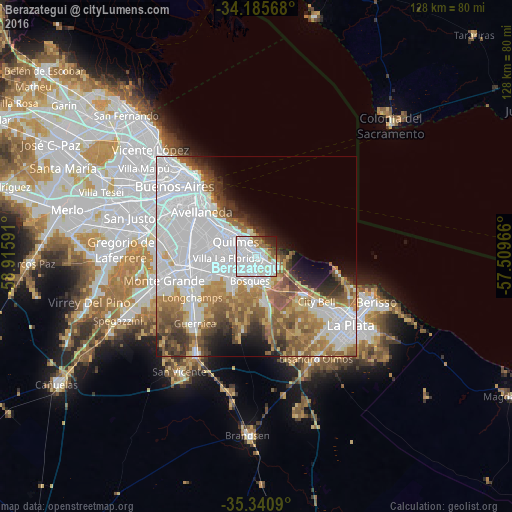
Analysis of Berazategui night lights 2016
Square area 10x10 km:
 51.65%
90-99
23.08%80-89
3.66%70-79
2.38%60-69
3.85%50-59
6.23%40-49
2.2%30-39
1.83%20-29
4.58%10-19
0.55%0-9
0%Square area 50x50 km:
23.17%90-99
8.58%80-89
3.75%70-79
4.71%60-69
6.85%50-59
6.93%40-49
4.23%30-39
3.97%20-29
3.83%10-19
4.97%0-9
29.01%Clear (daylight) street map image can be seen on geolist.org.
Map coordinates:
34° 11' 8.4" South, 58° 54' 57.3" West
34° 45' 55.1" South, 58° 12' 46" West
35° 20' 27.2" South, 57° 30' 34.8" West
Some cities around Berazategui sort by population:
• Buenos Aires
22.6 km =14 mi,  318°
318°
• Quilmes
6.2 km =3.9 mi,  310°
310°
• Balvanera
24.1 km =15 mi, 315°
• Villa Lugano
25.6 km =15.9 mi,  291°
291°
• Barracas
20.2 km =12.6 mi, 309°
• Boedo
23.7 km =14.7 mi, 308°
• Retiro
25.5 km =15.8 mi, 322°
• Adrogué
16.1 km =10 mi,  255°
255°
3436043 (p: 167,498)
Sources (retrieved 2019-11-25):
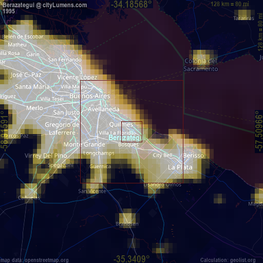
» NASA, Earths city lights 1995
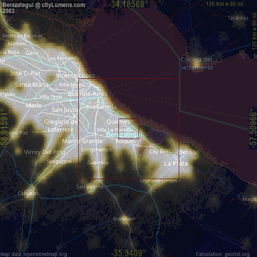
» NASA city lights 2003
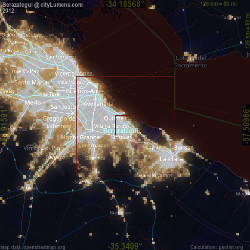
» Earth at Night: Flat Maps 2012, 2016