Retiro night lights from space
Night Light of Retiro (Buenos Aires F.D.) from space (Argentina) Src. Average luminocity for 10x10km area is 73.5717% and for 50x50km: 53.358%.
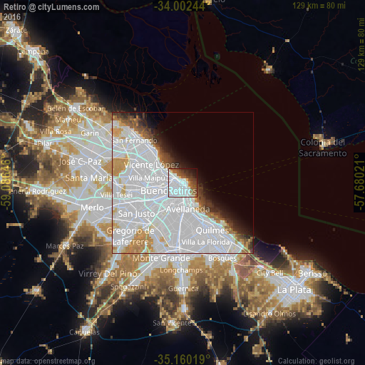
Analysis of Retiro night lights 2016
Square area 10x10 km:
 44.93%
90-99
9.44%80-89
2.97%70-79
0.17%60-69
4.72%50-59
9.62%40-49
9.27%30-39
5.59%20-29
5.77%10-19
6.29%0-9
1.22%Square area 50x50 km:
33.89%90-99
9.28%80-89
2.08%70-79
3.56%60-69
2.5%50-59
2.3%40-49
2.08%30-39
2.28%20-29
2.48%10-19
3.71%0-9
35.84%Clear (daylight) street map image can be seen on geolist.org.
Map coordinates:
34° 0' 8.8" South, 59° 5' 11.3" West
34° 34' 60" South, 58° 22' 60" West
35° 9' 36.7" South, 57° 40' 48.8" West
Some cities around Retiro sort by population:
• Buenos Aires
3.4 km =2.1 mi,  170°
170°
• Balvanera
3.3 km =2.1 mi,  203°
203°
• Belgrano
7.2 km =4.5 mi,  288°
288°
• Barracas
7.4 km =4.6 mi,  180°
180°
• Colegiales
6.1 km =3.8 mi,  280°
280°
• Boedo
6.3 km =3.9 mi,  208°
208°
• Villa Santa Rita
9.4 km =5.8 mi,  251°
251°
• Villa Ortúzar
7.8 km =4.8 mi,  272°
272°
3429576 (p: 38,635)
Sources (retrieved 2019-11-25):
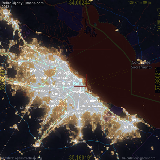
» Earth at Night: Flat Maps 2012, 2016