Lobito night lights from space
Night Light of Lobito (Benguela) from space (Angola) Src. Average luminocity for 10x10km area is 51.8368% and for 50x50km: 6.8491%.
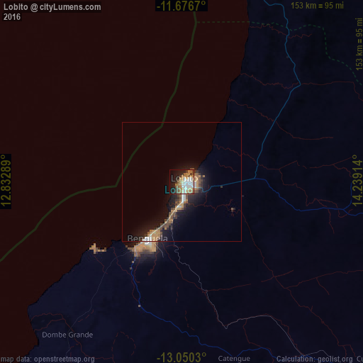
Analysis of Lobito night lights 2016
Square area 10x10 km:
 10.54%
90-99
11.98%80-89
2.89%70-79
9.92%60-69
12.19%50-59
5.37%40-49
4.34%30-39
5.99%20-29
6.82%10-19
22.31%0-9
7.64%Square area 50x50 km:
0.7%90-99
0.96%80-89
0.24%70-79
1.49%60-69
1.18%50-59
0.78%40-49
1.34%30-39
1.04%20-29
1.73%10-19
6.42%0-9
84.12%Clear (daylight) street map image can be seen on geolist.org.
Map coordinates:
11° 40' 36.1" South, 12° 49' 58.4" East
12° 21' 51.8" South, 13° 32' 9.6" East
13° 3' 1.1" South, 14° 14' 20.9" East
Some cities around Lobito sort by population:
• Benguela
27.5 km =17.1 mi,  211°
211°
• Sumbe
133.1 km =82.7 mi,  14°
14°
• Longonjo
195.8 km =121.7 mi,  107°
107°
• Caála
226.3 km =140.6 mi,  103°
103°
• Catumbela
7.4 km =4.6 mi,  170°
170°
• Uacu Cungo
205.3 km =127.6 mi,  56°
56°
• Caconda
225.1 km =139.9 mi,  132°
132°
• Chela
206.2 km =128.1 mi,  88°
88°
3347939 (p: 207,932)
Sources (retrieved 2019-11-25):
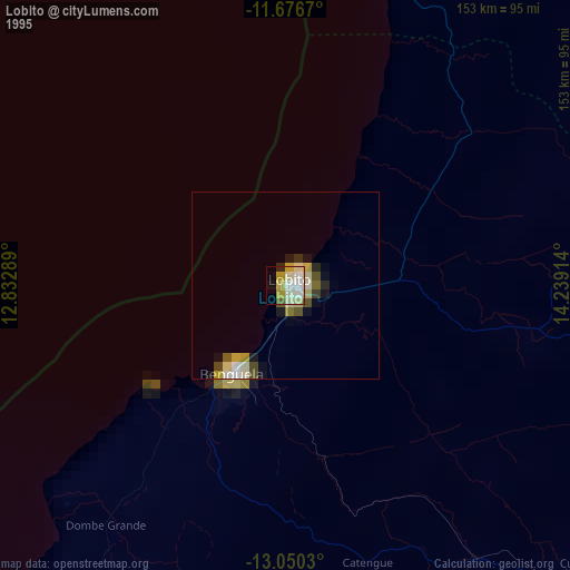
» NASA, Earths city lights 1995
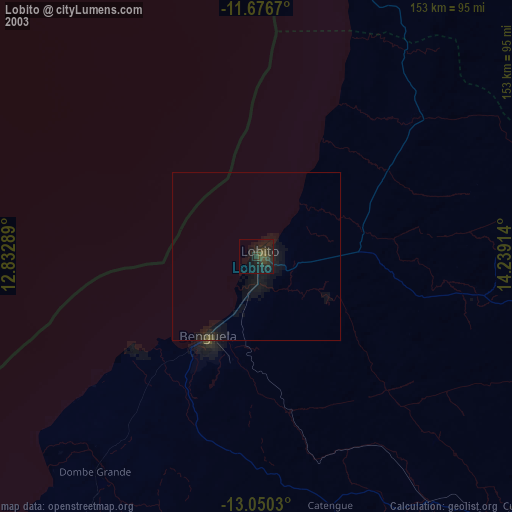
» NASA city lights 2003
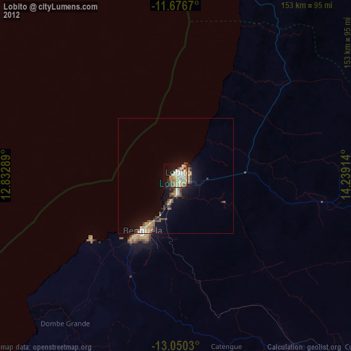
» Earth at Night: Flat Maps 2012, 2016