Paghmān night lights from space
Night Light of Paghmān (Kabul) from space (Afghanistan) Src. Average luminocity for 10x10km area is 5.9703% and for 50x50km: 11.9214%.
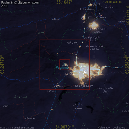
Analysis of Paghmān night lights 2016
Square area 10x10 km:
 0%
0%90-99
0%80-89
0%70-79
0%60-69
0.7%50-59
3.32%40-49
1.57%30-39
2.97%20-29
1.05%10-19
3.67%0-9
86.71%Square area 50x50 km:
2.62%90-99
2.58%80-89
2.77%70-79
0.84%60-69
0.95%50-59
1%40-49
1.42%30-39
1.51%20-29
2.45%10-19
3.89%0-9
79.98%Clear (daylight) street map image can be seen on geolist.org.
Map coordinates:
35° 9' 52.9" North, 68° 14' 52" East
34° 35' 16.3" North, 68° 57' 3.3" East
34° 0' 25.2" North, 69° 39' 14.5" East
Some cities around Paghmān sort by population:
• Kabul
21.3 km =13.2 mi,  108°
108°
• Charikar
51.4 km =31.9 mi,  23°
23°
• Baraki Barak
69 km =42.9 mi,  180°
180°
• Jabal os Saraj
64.5 km =40.1 mi, 23°
• Pul-e ‘Alam
66.2 km =41.1 mi,  174°
174°
• Sidqābād
60.6 km =37.7 mi,  37°
37°
• Mīr Bachah Kōṯ
23.7 km =14.7 mi, 40°
• Maydanshakhr
22.7 km =14.1 mi,  199°
199°
1131316 (p: 49,157)
Sources (retrieved 2019-11-25):
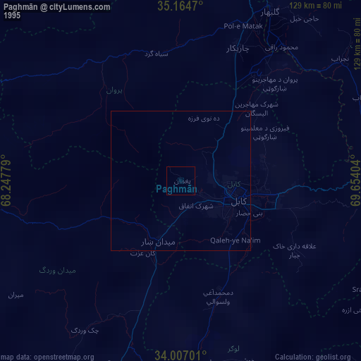
» NASA, Earths city lights 1995
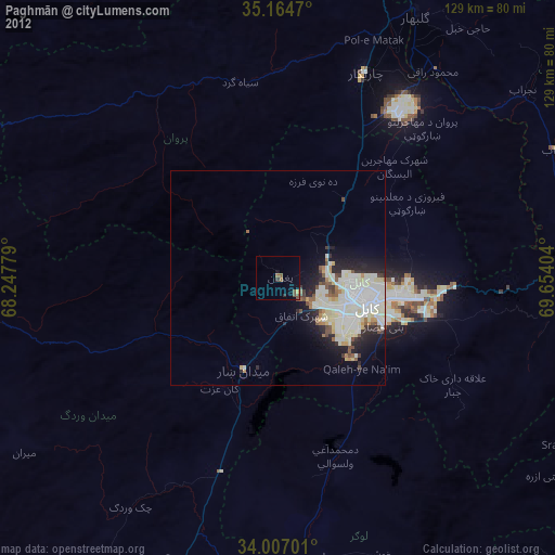
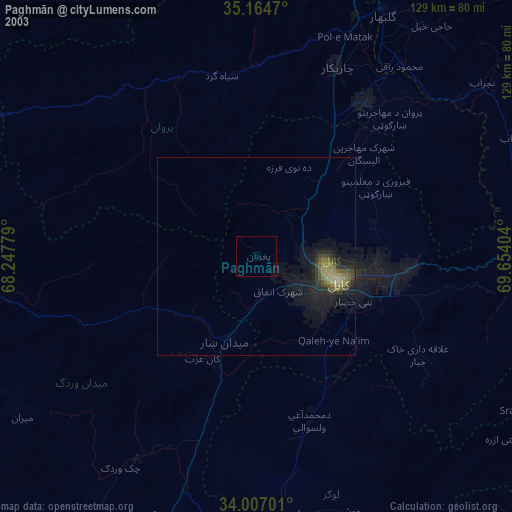
» NASA city lights 2003
» Earth at Night: Flat Maps 2012, 2016