Abu Dhabi night lights from space
Night Light of Abu Dhabi from space (United Arab Emirates) Src. Average luminocity for 10x10km area is 90.9504% and for 50x50km: 39.7491%.
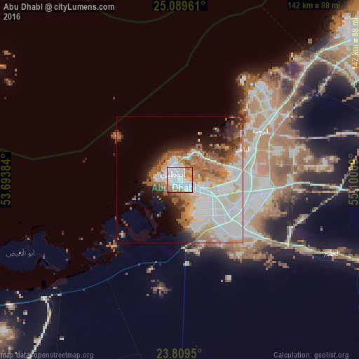
Analysis of Abu Dhabi night lights 2016
Square area 10x10 km:
 50.2%
50.2%90-99
21.83%80-89
1.98%70-79
11.11%60-69
11.9%50-59
2.58%40-49
0%30-39
0.4%20-29
0%10-19
0%0-9
0%Square area 50x50 km:
14.16%90-99
8.58%80-89
3.23%70-79
3.49%60-69
5.92%50-59
6.71%40-49
2.32%30-39
2.66%20-29
3.95%10-19
6.48%0-9
42.49%Clear (daylight) street map image can be seen on geolist.org.
Map coordinates:
25° 5' 22.6" North, 53° 41' 37.8" East
24° 27' 4.2" North, 54° 23' 49.1" East
23° 48' 34.2" North, 55° 6' 0.3" East
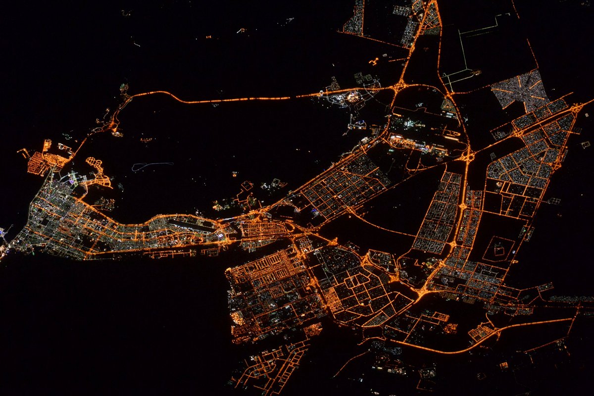
Fantastic image of Abu Dhabi from space taken by astronauts [src2], but I don't have information about it's orientation, scale or angle. If necessary, it was rotated manually, so North points approximately to upper direction. Click to zoom in:
Some cities around Abu Dhabi sort by population:
• Dubai
115.5 km =71.8 mi,  52°
52°
• Sharjah
142.1 km =88.3 mi, 46°
• Musaffah
13.4 km =8.3 mi,  139°
139°
• Khalifah A City
21.2 km =13.2 mi,  97°
97°
• Bani Yas City
28.3 km =17.6 mi,  123°
123°
• Zayed City
113.1 km =70.3 mi,  218°
218°
• Al Shamkhah City
32.1 km =19.9 mi, 101°
• Al Ain City
141.1 km =87.7 mi, 101°
292968 (p: 603,492)
Sources (retrieved 2019-11-25):
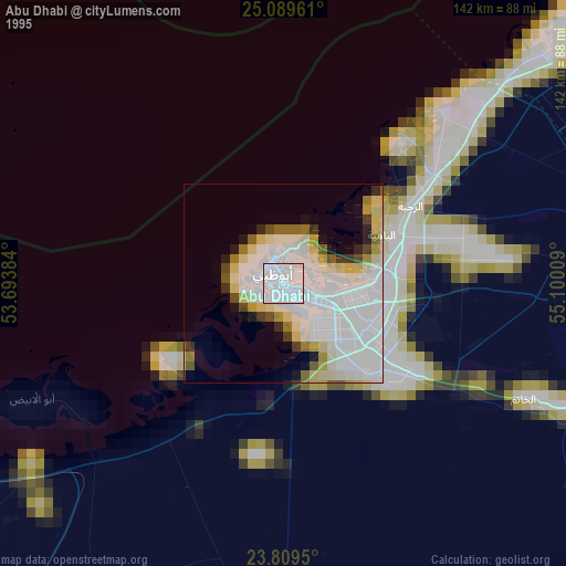
» NASA, Earths city lights 1995
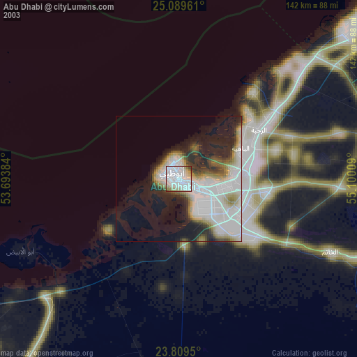
» NASA city lights 2003
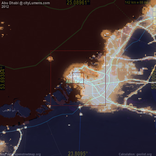
» Earth at Night: Flat Maps 2012, 2016
Src.2: Tim Kopra, Twitter/@astro_tim, 2016-05-12