Vereeniging night lights from space
Night Light of Vereeniging (Gauteng) from space (South Africa) Src. Average luminocity for 10x10km area is 74.6383% and for 50x50km: 32.4798%.
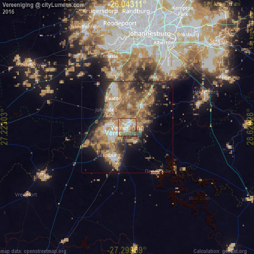
Analysis of Vereeniging night lights 2016
Square area 10x10 km:
 14.02%
90-99
12.5%80-89
10.23%70-79
24.24%60-69
16.29%50-59
13.45%40-49
7.39%30-39
1.7%20-29
0.19%10-19
0%0-9
0%Square area 50x50 km:
2.89%90-99
3.83%80-89
3.16%70-79
8.94%60-69
7.66%50-59
6.86%40-49
6.12%30-39
4.38%20-29
6.61%10-19
9.73%0-9
39.81%Clear (daylight) street map image can be seen on geolist.org.
Map coordinates:
26° 2' 35.2" South, 27° 13' 22.9" East
26° 40' 23.3" South, 27° 55' 34.1" East
27° 17' 58.9" South, 28° 37' 45.4" East
Some cities around Vereeniging sort by population:
• Soweto
45.6 km =28.3 mi,  351°
351°
• Vanderbijlpark
9.8 km =6.1 mi,  243°
243°
• Westonaria
48.1 km =29.9 mi,  324°
324°
• Sasolburg
19 km =11.8 mi,  214°
214°
• Heidelberg
47 km =29.2 mi,  66°
66°
• Fochville
47.6 km =29.6 mi,  295°
295°
• Deneysville
29.6 km =18.4 mi,  144°
144°
• Orange Farm
21.9 km =13.6 mi,  344°
344°
944385 (p: 474,681)
Sources (retrieved 2019-11-25):
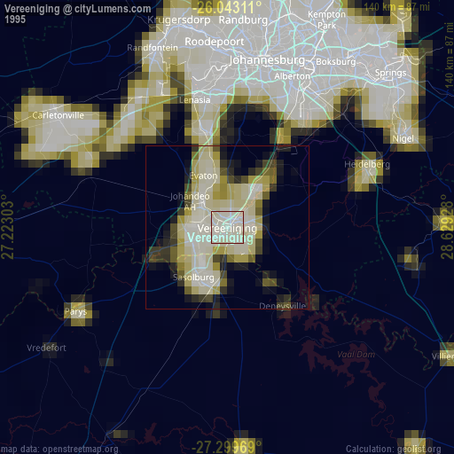
» NASA, Earths city lights 1995
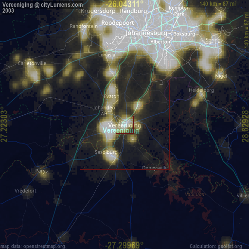
» NASA city lights 2003
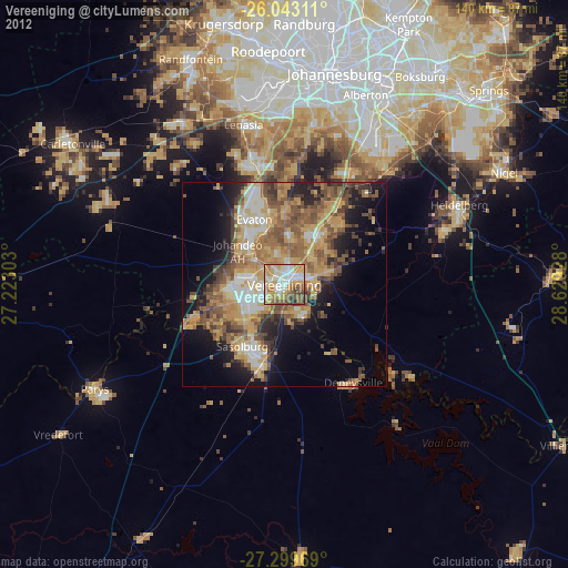
» Earth at Night: Flat Maps 2012, 2016