Nelspruit night lights from space
Night Light of Nelspruit (Mpumalanga) from space (South Africa) Src. Average luminocity for 10x10km area is 63.8294% and for 50x50km: 12.7024%.
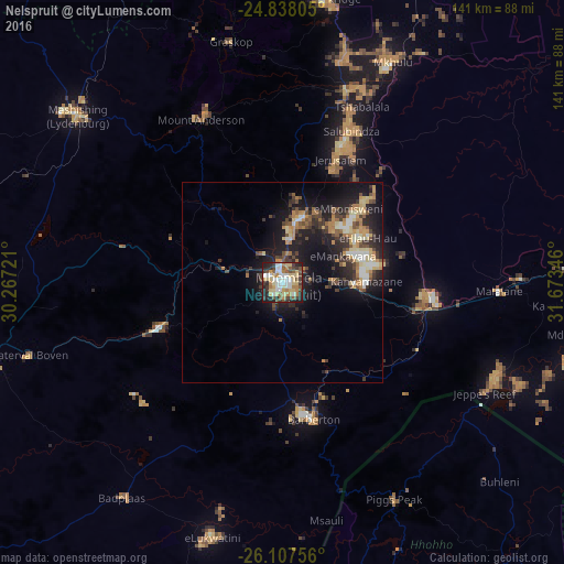
Analysis of Nelspruit night lights 2016
Square area 10x10 km:
 12.1%
12.1%90-99
13.49%80-89
14.88%70-79
6.55%60-69
8.53%50-59
8.73%40-49
8.33%30-39
9.72%20-29
13.1%10-19
4.56%0-9
0%Square area 50x50 km:
1.16%90-99
1.65%80-89
2.06%70-79
1.86%60-69
1.9%50-59
1.32%40-49
2.22%30-39
2.33%20-29
4.22%10-19
10.31%0-9
70.96%Clear (daylight) street map image can be seen on geolist.org.
Map coordinates:
24° 50' 17" South, 30° 16' 2" East
25° 28' 28.1" South, 30° 58' 13.2" East
26° 6' 27.2" South, 31° 40' 24.5" East
Some cities around Nelspruit sort by population:
• Mbabane, SZ
95.1 km =59.1 mi,  170°
170°
• Barberton
35.9 km =22.3 mi, 166°
• Lydenburg
67.6 km =42 mi,  308°
308°
• Komatipoort
98.9 km =61.5 mi,  87°
87°
• White River
16.4 km =10.2 mi,  14°
14°
• Belfast
96.8 km =60.1 mi,  255°
255°
• Thulamahashi
86.5 km =53.7 mi,  15°
15°
• Piggs Peak, SZ
60.7 km =37.7 mi,  152°
152°
971534 (p: 110,159)
Sources (retrieved 2019-11-25):
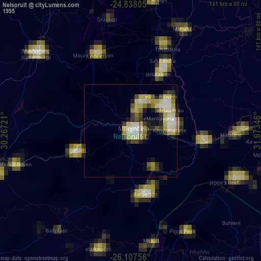
» NASA, Earths city lights 1995
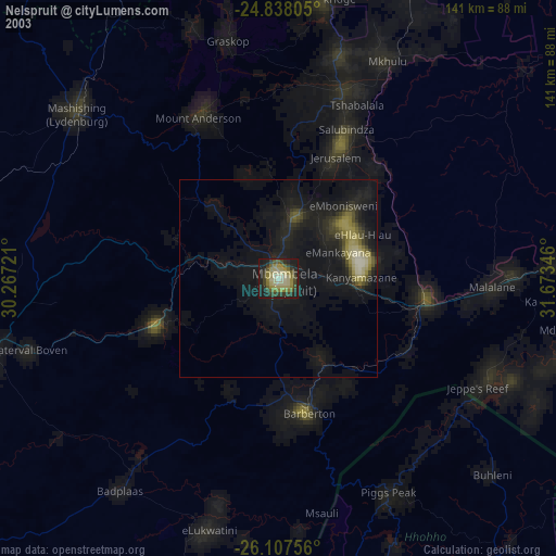
» NASA city lights 2003
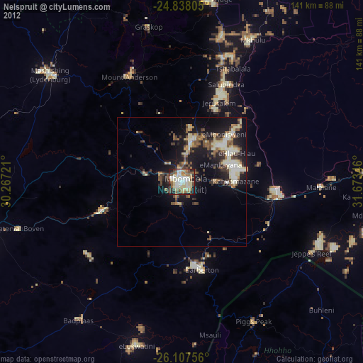
» Earth at Night: Flat Maps 2012, 2016