Mbabane night lights from space
Night Light of Mbabane (Hhohho) from space (Eswatini) Src. Average luminocity for 10x10km area is 46.379% and for 50x50km: 7.4588%.
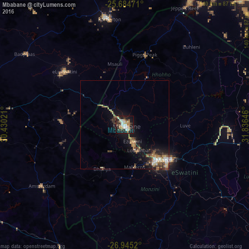

Analysis of Mbabane night lights 2016
Square area 10x10 km:
 10.52%
90-99
7.54%80-89
6.15%70-79
8.33%60-69
3.37%50-59
1.19%40-49
8.33%30-39
8.93%20-29
13.1%10-19
29.56%0-9
2.98%Square area 50x50 km:
0.84%90-99
0.86%80-89
1.11%70-79
1.04%60-69
1.02%50-59
0.71%40-49
1.46%30-39
1.52%20-29
1.83%10-19
5.73%0-9
83.88%Clear (daylight) street map image can be seen on geolist.org.
Map coordinates:
25° 41' 5" South, 30° 25' 48.8" East
26° 19' 0" South, 31° 7' 60" East
26° 56' 42.7" South, 31° 50' 11.3" East
Some cities around Mbabane sort by population:
• Manzini
31.8 km =19.8 mi,  129°
129°
• Piet Retief, ZA
83.1 km =51.6 mi,  202°
202°
• Barberton, ZA
59.3 km =36.8 mi,  352°
352°
• Malkerns
28.2 km =17.5 mi,  169°
169°
• Mhlume
78.1 km =48.5 mi,  66°
66°
• Siteki
82.5 km =51.3 mi,  100°
100°
• Piggs Peak
41.2 km =25.6 mi,  15°
15°
• Lobamba
18 km =11.2 mi,  158°
158°
934985 (p: 76,218)
Sources (retrieved 2019-11-25):
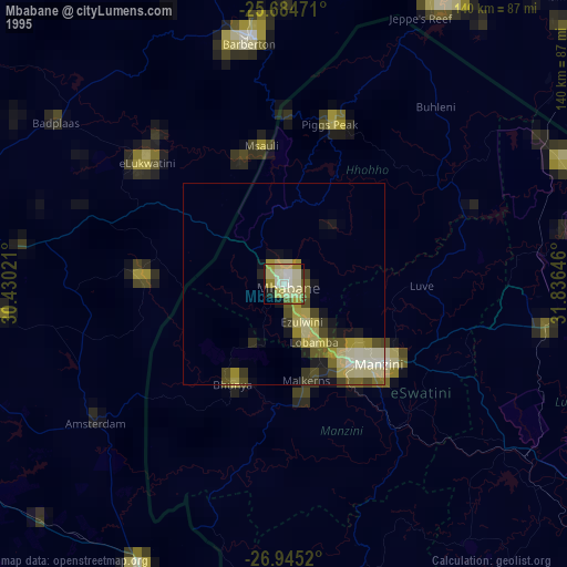
» NASA, Earths city lights 1995
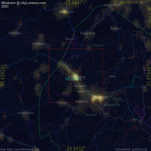
» NASA city lights 2003
» Earth at Night: Flat Maps 2012, 2016