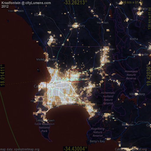
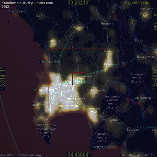
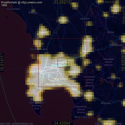
Kraaifontein night lights from space
Night Light of Kraaifontein (Western Cape) from space (South Africa) Src. Average luminocity for 10x10km area is 71.514% and for 50x50km: 40.6462%.
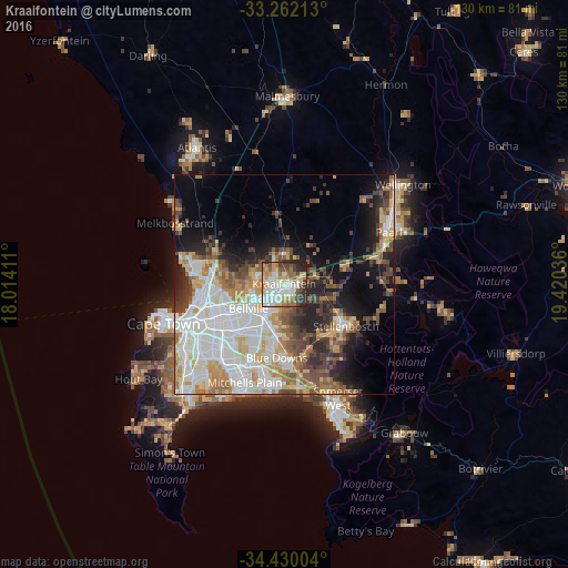
Analysis of Kraaifontein night lights 2016
Square area 10x10 km:
 17.13%
90-99
19.23%80-89
10.66%70-79
10.31%60-69
8.04%50-59
9.97%40-49
8.04%30-39
8.22%20-29
7.87%10-19
0.52%0-9
0%Square area 50x50 km:
11.12%90-99
8.7%80-89
5.04%70-79
5.06%60-69
4.31%50-59
5.03%40-49
4.62%30-39
5.01%20-29
6.52%10-19
9.84%0-9
34.76%Clear (daylight) street map image can be seen on geolist.org.
Map coordinates:
33° 15' 43.7" South, 18° 0' 50.8" East
33° 50' 53.1" South, 18° 43' 2" East
34° 25' 48.1" South, 19° 25' 13.3" East
Some cities around Kraaifontein sort by population:
• Cape Town
28.5 km =17.7 mi,  252°
252°
• Paarl
27 km =16.8 mi,  61°
61°
• Stellenbosch
16.8 km =10.4 mi,  124°
124°
• Lansdowne
25.5 km =15.8 mi,  232°
232°
• Rondebosch
25.7 km =16 mi,  240°
240°
• Claremont
27.5 km =17.1 mi, 237°
• Rosebank
25.4 km =15.8 mi, 241°
• Newlands
28.8 km =17.9 mi, 239°
3365083 (p: 57,911)
Sources (retrieved 2019-11-25):
» NASA, Earths city lights 1995
» NASA city lights 2003
» Earth at Night: Flat Maps 2012, 2016