Štrpce night lights from space
Night Light of Štrpce (Ferizaj) from space (Kosovo) Src. Average luminocity for 10x10km area is 2.9545% and for 50x50km: 3.8538%.
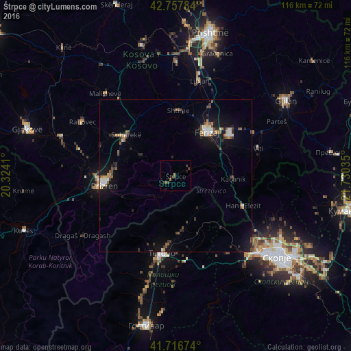
Analysis of Štrpce night lights 2016
Square area 10x10 km:
 0%
0%90-99
0%80-89
0%70-79
0.15%60-69
1.06%50-59
0.15%40-49
2.12%30-39
1.97%20-29
0.15%10-19
0.45%0-9
93.94%Square area 50x50 km:
0.34%90-99
0.49%80-89
0.29%70-79
0.39%60-69
0.41%50-59
0.67%40-49
0.55%30-39
0.7%20-29
0.93%10-19
3.64%0-9
91.6%Clear (daylight) street map image can be seen on geolist.org.
Map coordinates:
42° 45' 28.2" North, 20° 19' 26.8" East
42° 14' 22" North, 21° 1' 38" East
41° 43' 0.3" North, 21° 43' 49.3" East
Some cities around Štrpce sort by population:
• Prizren
23.8 km =14.8 mi,  263°
263°
• Suva Reka
21.3 km =13.2 mi,  308°
308°
• Ferizaj
18 km =11.2 mi,  35°
35°
• Shtime
21.6 km =13.4 mi,  2°
2°
• Tearce, MK
18.2 km =11.3 mi,  173°
173°
• Kačanik
19.1 km =11.9 mi,  92°
92°
• Džepčište, MK
23.1 km =14.4 mi,  185°
185°
• Jegunovce, MK
20.2 km =12.6 mi,  156°
156°
785388 (p: 6,913)
Sources (retrieved 2019-11-25):
» Earth at Night: Flat Maps 2012, 2016