Shtime night lights from space
Night Light of Shtime (Ferizaj) from space (Kosovo) Src. Average luminocity for 10x10km area is 1.719% and for 50x50km: 6.0075%.
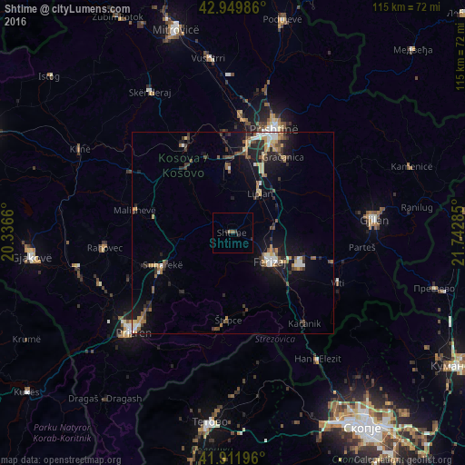

Analysis of Shtime night lights 2016
Square area 10x10 km:
 0%
0%90-99
0%80-89
0%70-79
0%60-69
0%50-59
1.27%40-49
0%30-39
0.63%20-29
1.9%10-19
0%0-9
96.19%Square area 50x50 km:
0.49%90-99
0.77%80-89
0.68%70-79
0.83%60-69
0.68%50-59
0.92%40-49
1%30-39
1.05%20-29
1.77%10-19
4.74%0-9
87.08%Clear (daylight) street map image can be seen on geolist.org.
Map coordinates:
42° 56' 59.5" North, 20° 20' 11.8" East
42° 25' 59" North, 21° 2' 23" East
41° 54' 43.1" North, 21° 44' 34.3" East
Some cities around Shtime sort by population:
• Suva Reka
19.5 km =12.1 mi,  244°
244°
• Ferizaj
11.8 km =7.3 mi,  126°
126°
• Glogovac
24.8 km =15.4 mi,  331°
331°
• Llazicë
26.4 km =16.4 mi,  300°
300°
• Kosovo Polje
26.1 km =16.2 mi,  10°
10°
• Lipljan
12.1 km =7.5 mi,  35°
35°
• Štrpce
21.6 km =13.4 mi,  182°
182°
• Mamuša
28.1 km =17.5 mi,  246°
246°
785485 (p: 35,000)
Sources (retrieved 2019-11-25):
» Earth at Night: Flat Maps 2012, 2016