Leposaviq night lights from space
Night Light of Leposaviq (Mitrovica) from space (Kosovo) Src. Average luminocity for 10x10km area is 3.0242% and for 50x50km: 2.2793%.
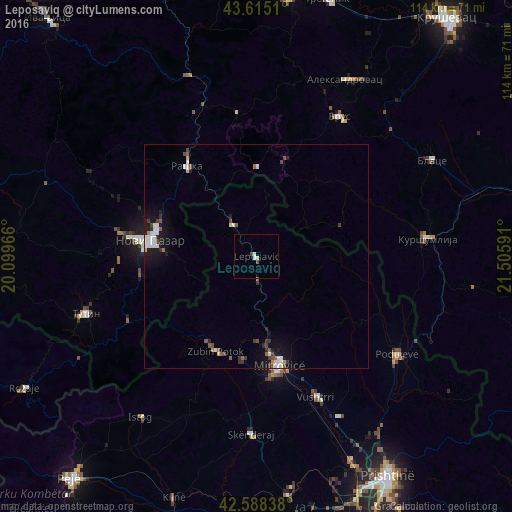
Analysis of Leposaviq night lights 2016
Square area 10x10 km:
 1.06%
1.06%90-99
0.45%80-89
0.3%70-79
0%60-69
0%50-59
0.61%40-49
0.91%30-39
0%20-29
0%10-19
0%0-9
96.67%Square area 50x50 km:
0.48%90-99
0.47%80-89
0.08%70-79
0.08%60-69
0.13%50-59
0.4%40-49
0.38%30-39
0.38%20-29
0.35%10-19
1.55%0-9
95.71%Clear (daylight) street map image can be seen on geolist.org.
Map coordinates:
43° 36' 54.4" North, 20° 5' 58.8" East
43° 6' 14" North, 20° 48' 10" East
42° 35' 18.2" North, 21° 30' 21.3" East
Some cities around Leposaviq sort by population:
• Mitrovicë
25.1 km =15.6 mi,  168°
168°
• Novi Pazar, RS
23.9 km =14.9 mi,  278°
278°
• Istok
44.1 km =27.4 mi,  215°
215°
• Podujeva
38.3 km =23.8 mi,  124°
124°
• Vushtrri
34 km =21.1 mi,  156°
156°
• Zvečan
22 km =13.7 mi, 172°
• Zubin Potok
23 km =14.3 mi,  203°
203°
• Srbica
39.7 km =24.7 mi,  181°
181°
788731 (p: 19,000)
Sources (retrieved 2019-11-25):
» Earth at Night: Flat Maps 2012, 2016