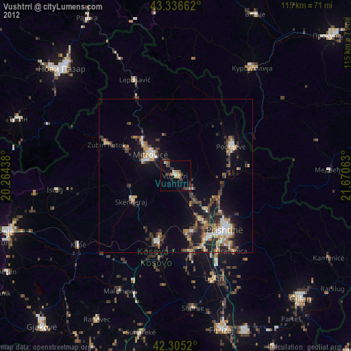
Vushtrri night lights from space
Night Light of Vushtrri (Mitrovica) from space (Kosovo) Src. Average luminocity for 10x10km area is 5.2076% and for 50x50km: 5.2523%.
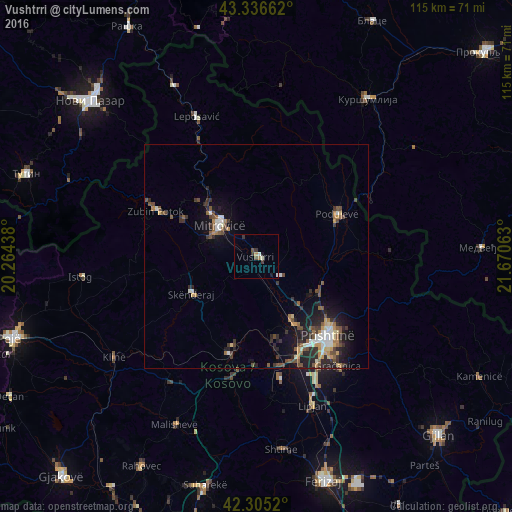
Analysis of Vushtrri night lights 2016
Square area 10x10 km:
 0.3%
0.3%90-99
1.52%80-89
0%70-79
0.45%60-69
0.76%50-59
0.45%40-49
0.91%30-39
2.27%20-29
0%10-19
1.21%0-9
92.12%Square area 50x50 km:
0.55%90-99
0.71%80-89
0.39%70-79
0.72%60-69
0.57%50-59
0.94%40-49
1.06%30-39
1.1%20-29
1.63%10-19
3.26%0-9
89.06%Clear (daylight) street map image can be seen on geolist.org.
Map coordinates:
43° 20' 11.8" North, 20° 15' 51.8" East
42° 49' 23" North, 20° 58' 3" East
42° 18' 18.7" North, 21° 40' 14.3" East
Some cities around Vushtrri sort by population:
• Pristina
23.3 km =14.5 mi,  135°
135°
• Mitrovicë
10.6 km =6.6 mi,  309°
309°
• Glogovac
22.5 km =14 mi,  195°
195°
• Podujeva
20.8 km =12.9 mi,  62°
62°
• Zvečan
14 km =8.7 mi, 312°
• Kosovo Polje
20.6 km =12.8 mi,  149°
149°
• Obiliq
17.3 km =10.7 mi, 150°
• Srbica
16.9 km =10.5 mi,  239°
239°
784097 (p: 30,651)
Sources (retrieved 2019-11-25):
» Earth at Night: Flat Maps 2012, 2016