Huế night lights from space
Night Light of Huế (Thừa Thiên-Huế) from space (Vietnam) Src. Average luminocity for 10x10km area is 56.8264% and for 50x50km: 4.8241%.
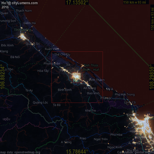
Analysis of Huế night lights 2016
Square area 10x10 km:
 6.82%
6.82%90-99
10.33%80-89
11.78%70-79
14.26%60-69
9.92%50-59
7.85%40-49
3.51%30-39
4.96%20-29
13.43%10-19
17.15%0-9
0%Square area 50x50 km:
0.28%90-99
0.59%80-89
0.73%70-79
0.91%60-69
0.64%50-59
0.56%40-49
0.61%30-39
0.79%20-29
1.31%10-19
3.89%0-9
89.7%Clear (daylight) street map image can be seen on geolist.org.
Map coordinates:
17° 8' 6.1" North, 106° 53' 32.4" East
16° 27' 42.8" North, 107° 35' 43.7" East
15° 47' 11.2" North, 108° 17' 54.9" East
Some cities around Huế sort by population:
• Da Nang
79.9 km =49.6 mi,  123°
123°
• Tam Kỳ
136.3 km =84.7 mi,  136°
136°
• Quảng Ngãi
196.6 km =122.2 mi, 139°
• Hội An
102.1 km =63.4 mi,  129°
129°
• Kwang Binh
152.5 km =94.8 mi,  317°
317°
• Ðông Hà
65.8 km =40.9 mi,  306°
306°
• Salavan, LA
150.7 km =93.6 mi,  236°
236°
• Sekong, LA
155.2 km =96.4 mi,  216°
216°
1580240 (p: 287,217)
Sources (retrieved 2019-11-25):
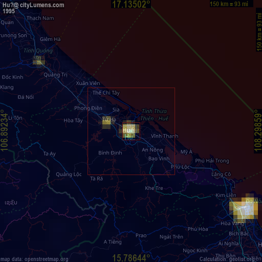
» NASA, Earths city lights 1995
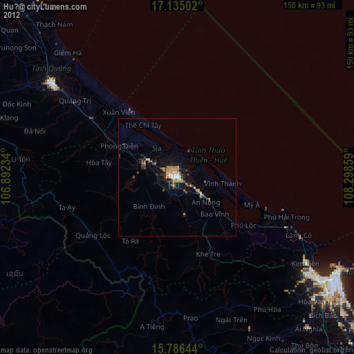
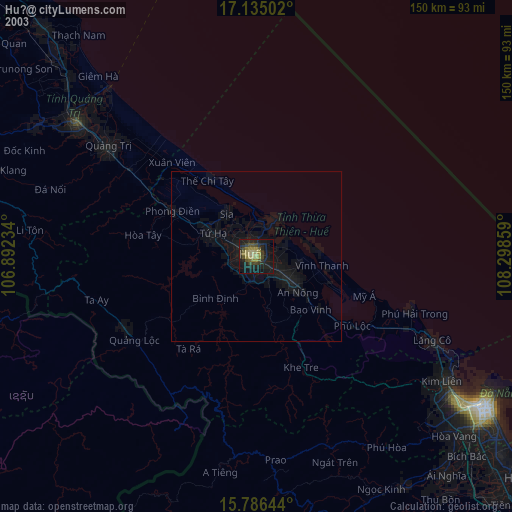
» NASA city lights 2003
» Earth at Night: Flat Maps 2012, 2016