Hanoi night lights from space
Night Light of Hanoi from space (Vietnam) Src. Average luminocity for 10x10km area is 97.6706% and for 50x50km: 49.248%.
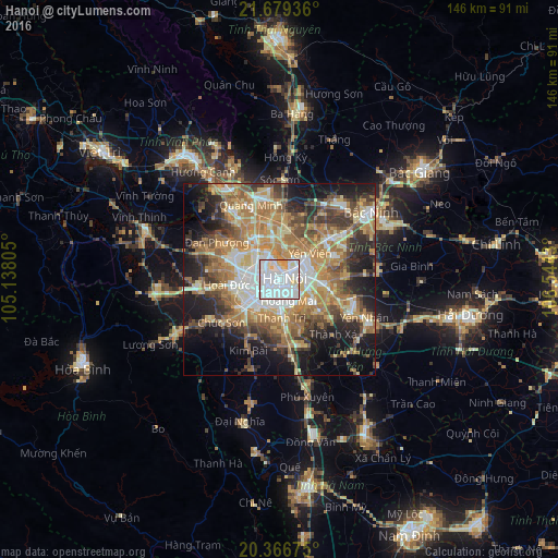
Analysis of Hanoi night lights 2016
Square area 10x10 km:
 66.07%
90-99
24.6%80-89
5.95%70-79
3.37%60-69
0%50-59
0%40-49
0%30-39
0%20-29
0%10-19
0%0-9
0%Square area 50x50 km:
8.4%90-99
6.82%80-89
6.92%70-79
8.82%60-69
12.17%50-59
7.25%40-49
6.92%30-39
7.23%20-29
8.11%10-19
13.76%0-9
13.6%Clear (daylight) street map image can be seen on geolist.org.
Map coordinates:
21° 40' 45.7" North, 105° 8' 17" East
21° 1' 28.2" North, 105° 50' 28.2" East
20° 22' 0.3" North, 106° 32' 39.5" East
Some cities around Hanoi sort by population:
• Cung Kiệm
37.8 km =23.5 mi,  61°
61°
• Hải Dương
51.9 km =32.2 mi,  100°
100°
• Bắc Giang
45.9 km =28.5 mi,  52°
52°
• Hà Đông
8.8 km =5.5 mi,  227°
227°
• Bắc Ninh
30.3 km =18.8 mi, 53°
• Sơn Tây
37 km =23 mi,  290°
290°
• Hưng Yên
47.4 km =29.5 mi,  152°
152°
• Vĩnh Yên
40 km =24.9 mi,  322°
322°
1581130 (p: 1,431,270)
Sources (retrieved 2019-11-25):
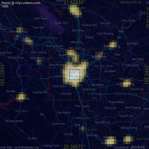
» NASA, Earths city lights 1995
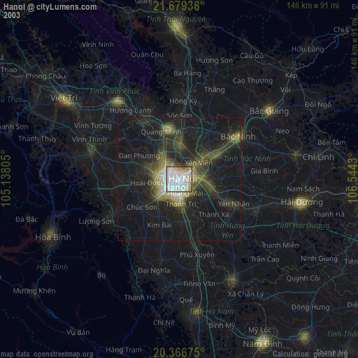
» NASA city lights 2003
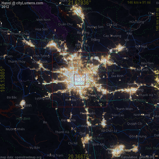
» Earth at Night: Flat Maps 2012, 2016