Bắc Ninh night lights from space
Night Light of Bắc Ninh from space (Vietnam) Src. Average luminocity for 10x10km area is 63.5258% and for 50x50km: 26.9024%.
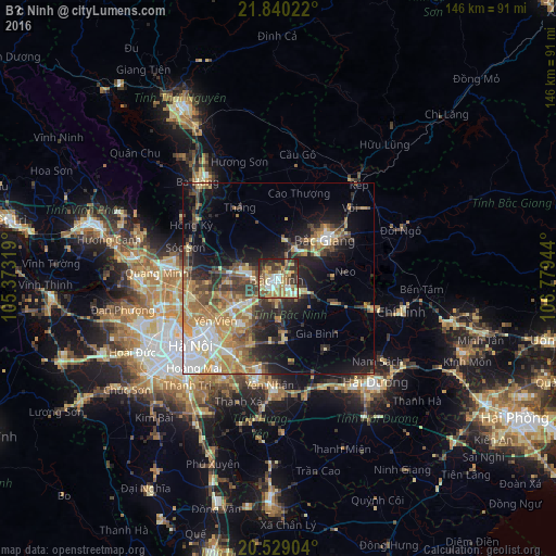
Analysis of Bắc Ninh night lights 2016
Square area 10x10 km:
 9.13%
9.13%90-99
11.31%80-89
14.09%70-79
9.52%60-69
11.51%50-59
10.91%40-49
9.52%30-39
10.71%20-29
12.3%10-19
0.99%0-9
0%Square area 50x50 km:
3.46%90-99
3.22%80-89
4.21%70-79
4.63%60-69
5.58%50-59
3.83%40-49
4.36%30-39
4.54%20-29
6.15%10-19
11.3%0-9
48.72%Clear (daylight) street map image can be seen on geolist.org.
Map coordinates:
21° 50' 24.8" North, 105° 22' 23.5" East
21° 11' 9.9" North, 106° 4' 34.7" East
20° 31' 44.5" North, 106° 46' 46" East
Some cities around Bắc Ninh sort by population:
• Hanoi
30.3 km =18.8 mi,  233°
233°
• Thái Nguyên
51.2 km =31.8 mi,  332°
332°
• Cung Kiệm
8.8 km =5.5 mi,  89°
89°
• Hải Dương
38.1 km =23.7 mi,  135°
135°
• Bắc Giang
15.6 km =9.7 mi,  51°
51°
• Hà Đông
39 km =24.2 mi, 232°
• Sơn Tây
59.3 km =36.8 mi,  265°
265°
• Vĩnh Yên
50.7 km =31.5 mi,  285°
285°
1591449 (p: 43,564)
Sources (retrieved 2019-11-25):
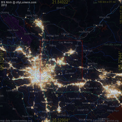
» Earth at Night: Flat Maps 2012, 2016